 SNS Group
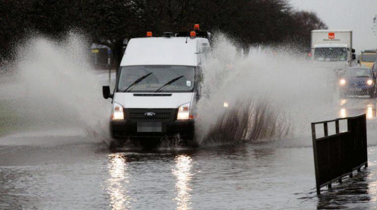
Flooding has closed major sections of the A90 as drivers are being warned to avoid the area.
The adverse weather comes following yellow flood warnings from SEPA for many parts of the north including Aberdeenshire, Dundee and Angus and Tayside on Thursday and Friday.
The A90 at Boddam and at Lonmay were closed in both directions around 6.30am due to flooding on the carriageway while at the Toll of Birness the road is restricted.
Police Scotland and AMEY are said to be on the scene.
A SEPA statement said: “On Wednesday, localised coastal flooding impacts are possible in the Western Isles, the southwest and Moray due to high water levels.
“Localised coastal flooding impacts are more likely from Thursday around much of the coast of Scotland.
“On Wednesday and Thursday localised flooding impacts from rivers and surface water are possible in southern, central and north-eastern areas due to periods of heavy rain moving north over the country.
“Further flooding impacts from rivers and surface water are possible in the southwest of Scotland on Friday.”
Traffic Scotland said: “The A90 near Lonmay is currently affected in both directions by flooding. Motorists are advised to use caution on approach.
“A90 Boddam, is currently closed in both directions due to flooding affecting the carriageway, road users should seek an alternative route at this time.”
“A90 Toll of Birness, is currently restricted in both directions due to flooding affecting the carriageway, road users should approach with caution.”
Amey NE Trunk Roads posted on X: “Road closed due to flooding between Boddam and Peterhead.
“Police and Amey in area. Take care on approach.”
Network Rail said speed restrictions are in place on the East Coast Main Line between Grantshouse and Berwick and on the Aberdeen to Dundee line between Laurencekirk and Portlethen due to heavy rain.
Where are the yellow flood warnings in Scotland this week?
On Thursday, a number of areas are at risk of being affected:
- Aberdeenshire and Aberdeen City, Caithness and Sutherland, Central, Dumfries and Galloway, Dundee and Angus, Easter Ross and Great Glen, Fife, Findhorn Nairn Moray and Speyside, Orkney, Shetland, Skye and Lochaber, Tayside, Wester Ross, Western Isles.
On Friday, a number of warnings are in place:
- Aberdeenshire and Aberdeen City, Caithness and Sutherland, Central, Dumfries and Galloway, Dundee and Angus, Easter Ross and Great Glen, Fife, Findhorn Nairn Moray and Speyside, Orkney, Shetland, Skye and Lochaber, Tayside, Wester Ross, Western Isles.

Insight Sean Batty STV News Meteorologist
Over the past few days, computer models have been consistently predicting the development of a low-pressure system in the Atlantic, which looks set to intensify into a storm likely to impact Scotland this weekend.
It’s looking highly likely this is going to be named, and I expect warnings will be issued as we get closer to the weekend once there’s a bit more detail on track and intensity of the system.
The UK storm season officially resets in early September, so if the storm is named, it will be Ashley – the first of the season. The last named storm to affect the UK was Lilian in August, which brought heavy rain to the Borders and wind gusts reaching 60 mph on the mountain tops.
This will be the first spell of proper autumn gales for the country with most of the country experiencing a period of strong winds through Sunday and into Monday. Models are currently indicating that wind gusts could reach 70-75 mph in the most exposed parts of the Hebrides and Northern Isles.
This upcoming storm will mark the first significant autumn gales of the year, with much of the UK set to experience strong winds through Sunday and into Monday. Current models suggest gusts could reach 70-75 mph in the most exposed areas of the Hebrides and Northern Isles. Elsewhere, gusts of 50-60 mph are expected, and if the storm track holds, we could see a spell of particularly strong gusts sweeping across the central belt on Sunday night.
Adding to the potential hazards, we’re currently in a period of spring tides, when high tides are higher than usual. Combined with the strong winds, this increases the risk of coastal flooding and large waves along the coast.
As I say, the details of this system are still being watched, but expect to see some warnings in the coming days, and expect disruption if you’re planning a ferry trip on Sunday or Monday.
Follow STV News on WhatsApp
Scan the QR code on your mobile device for all the latest news from around the country