Key Points
-
 Storm Floris to bring gusts of up to 90mph throughout Monday
 - Train services in Glasgow. Stirling and Hamilton disrupted by trees and wire damage
- Amber warning covering most of Scotland in place until 11pm
- Fire at Glasgow’s King Park station affecting overhead wires
- Police warning drivers not to travel after campervans blown over on A87
- Yellow warning covering the whole of Scotland also in place until midnight
- Trailer overturned on the Kingston Bridge causing delays on M8
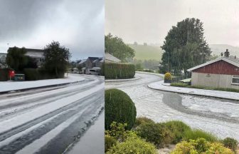
Scotland is being battered by “unseasonably” strong winds as an amber warning is in place during Storm Floris.
The amber alert has been issued for much of the country, lasting from 10am until 11pm.
A second yellow alert, covering the whole of Scotland, will be in place until midnight.
A third yellow weather warning will come into force at midnight, covering Orkney and Shetland until 8am on Tuesday.
Gusts of 50 to 70mph have been forecast for many parts and are likely to reach 80 to 90mph on some exposed coasts, hills, and bridges.
Heavy rain is also forecast for some areas, and gusts could reach 90mph in exposed spots.
The forecaster has urged the public to stay indoors “as much as possible” with high winds creating a risk of injury.


A fallen tree on the A78 Inverkip Road at Lady Alice Bowling Club in Greenock closed the road both ways before it reopened.
A fallen tree is partially blocking the road in both directions on the A82 at Onich with traffic said to be very heavy on approach.
Meanwhile, flooding on the same road at Fairlie closed a lane with drivers still being urged to use caution on approach.
A trailer overturned on the Kingston Bridge around 12.40pm on Monday, causing one lane on the M8 to be blocked.
A number of bridges including the Tyne, Dornoch and Forth Road are closed to all traffic.
The Tay Road Bridge has also been closed in both directions due to the “high winds”.
Public transport cancellations
Trains and ferries have already been cancelled, with Network Rail closing a number of routes at midday on Monday.
Network Rail said a fire on the overhead wires near Kings Park station in Glasgow’s south side was identified.
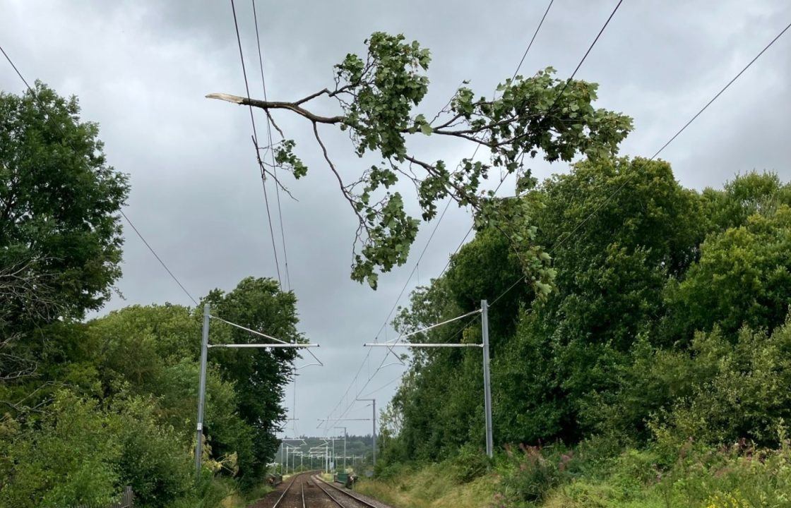
A fallen tree on the Glasgow Queen Street to Cumbernauld route caused disruption for commuters, with Network Rail engineers deployed to remove it.
Another tree resting on the overhead wires at Cornton level crossing also affected services near Stirling, blocking both tracks.
The operator said “significant damage” to the overhead wires in the Hamilton Circle area was identified. Due to the weather, repairs are likely to take several hours.
Scottish ferry operator CalMac has issued a series of cancellation warnings ahead of the storm.
“Disruption to sailings is expected across our network on Monday August 4 due to forecasted strong winds across parts of Scotland’s west coast,” it posted on X.
All other routes will see a reduced timetable and longer journey times due to speed restrictions.
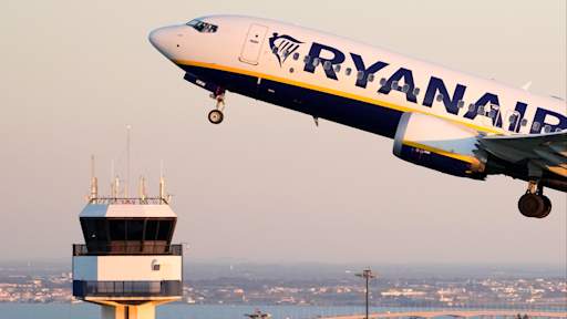
A number of flights at Scottish airports have been cancelled due to high winds, with passengers urged to check with airline operators if their flight is still on schedule.
Edinburgh – Fife/Perth/Dundee, Perth – Dundee/Aberdeen/Inverness, and Inverness – Aberdeen/Wick/Thurso/Kyle of Lochalshare are among a number of lines that will close from noon.
Train operator LNER has warned passengers not to travel north of Newcastle on Monday as a result of the forecast.
Those intending to travel on Monday can do so until Wednesday, the operator said.
Avanti West Coast advised passengers not to travel north of Preston on Monday as it expects its Scottish-English routes to be “heavily affected” by Storm Floris.
The operator said services are likely to be impacted in Lancaster, Oxenholme, Penrith, Carlisle, Lockerbie, Motherwell, Haymarket, Glasgow Central and Edinburgh.
Tickets dated for Monday for these areas will be accepted on Tuesday, it added.
Network Rail engineers responded to a loss of power at Hamilton around 7am on Monday, with services between Blantyre affected.
Trains from Glasgow Queen Street towards Edinburgh or Stirling are unable to run after a large polythene sheet got caught on the overhead wires near Bishopbriggs.
Network Rail staff are on the scene to inspect the issue.
ScotRail believe the overall disruption caused by Storm Floris will continue into Tuesday morning due to the “significant clean-up operation.”
Mark Ilderton, ScotRail Service Delivery Director, said: “We’re sorry to customers who have been impacted by the disruption caused by Storm Floris.
“Network Rail and ScotRail teams are working flat out to recover services as quickly as possible, but some disruption will continue into Tuesday.
“We’re advising customers to check their journey before they travel via the ScotRail website, mobile app, or social media feeds.”
Homes left without power
SSEN has confirmed that around 28,000 homes in the Highlands, Moray, and in Aberdeenshire have been impacted by Storm Floris, which has damaged the network.
Power has been restored to 5,500 properties, and work is ongoing to restore power to the other homes. The Distribution Network Operator has confirmed they expect more homes to be impacted by the adverse weather.
Scottish Power has confirmed they are dealing with 1,000 properties left without power.
A spokesperson said: “Our network is holding up well and operating as normal, with around 1,000 customers currently off supply. We’ve been preparing for Storm Floris over the weekend and have resources at the ready across our region to respond immediately if needed.”
Warning issued to drivers
Elsewhere, motorists have been urged to slow down in poor weather and avoid exposed Highland and coastal routes.
Rod Dennis, of the RAC breakdown service, said: “This unseasonable bout of stormy weather will mean drivers in the north and west of the UK need to take extra care at the start of next week.
“It’s the height of the holiday season, so those towing trailers and caravans, as well as those with roof and tent boxes, must ensure their loads are properly secured.”

Edinburgh’s Military Tattoo performance set for Monday has also been cancelled, organisers said.
The event has only previously been cancelled in 2020 and 2021 due to the Covid pandemic.
Public urged to plan ahead
Cabinet secretary for transport Fiona Hyslop said: “Key partners have met to discuss preparations for next week and conditions will be monitored over the weekend and into next week.
“Given the unusual timing and the fact that some people will be on holiday, travelling or perhaps unaware, we are trying to raise even more awareness than usual of this potentially disruptive storm.
“Please check with operators as we do expect rail, ferries, roads and bridges to be disrupted on Monday across the country.
“This is a slightly unusual situation for August, however, the message is the same as winter – plan ahead, check your journey in advance, allow extra time, and don’t take any unnecessary risks. Officials will be monitoring the situation and are ready to stand up the Multi-Agency Response Team, if required.
“I am grateful to those who are giving up their weekend and time off to help co-ordinate the transport sector’s response. Traffic Scotland, Police Scotland, SEPA, local authorities and others will communicate any closures to the public and provide real-time updates.”

Insight Philip Petrie STV weather presenter
Storm Floris has deepened rapidly and is currently making its way across Scotland, bringing with it heavy rain and unseasonably strong winds. The rain isn’t too much of a concern in terms of rainfall totals, with the strong winds being our main concern.
As of 11.45am we have already broken several August gust records across the country, and winds are still set to intensify throughout the afternoon so we are expecting further records to fall.
Floris clears away into the North Sea tomorrow but Tuesday will still be a windy and blustery day overall for Scotland, with heavy scattered showers mainly focused around central and western areas. The showers will move through quickly, so after a quick sharp downpour we will see some drier spells later on in the day.
Looking ahead to Wednesday a ridge of high pressure builds and the winds will ease temporarily giving us a quieter and drier day overall, a brief respite, with some brighter spells, before another low pressure system approaches from the west bringing another wet spell overnight into Thursday.
Where does the amber warning cover?
• Highlands & Eilean Siar (Highland, Na h-Eileanan Siar)
• Central, Tayside & Fife (Angus, Clackmannanshire, Dundee, Falkirk, Fife, Perth and Kinross, Stirling)
• Grampian (Aberdeen, Aberdeenshire, Moray)
• SW Scotland, Lothian Borders, East Lothian, Edinburgh, Midlothian Council, Scottish Borders, West Lothian)
• Strathclyde (Argyll and Bute, East Ayrshire, East Dunbartonshire, East Renfrewshire, Glasgow, Inverclyde, North Ayrshire, North Lanarkshire, Renfrewshire, South Lanarkshire, West Dunbartonshire)
Follow STV News on WhatsApp
Scan the QR code on your mobile device for all the latest news from around the country