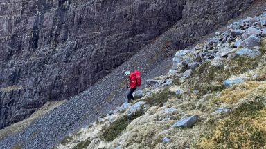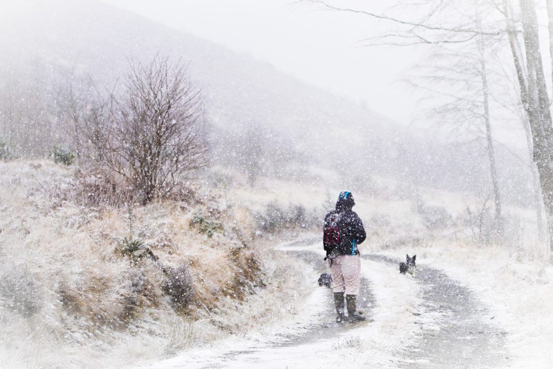
Scotland is facing icy conditions and patches of snow as temperatures drop across the country.
The Met Office has issued yellow alerts, which start at 3pm and remain in place until 10am on Tuesday.
The majority of the country has been warned to brace for severe weather, with rain, snow and sleet possible and widespread ice forecast.
The warning zone is large, mainly to cover the risk of ice across a wide area.
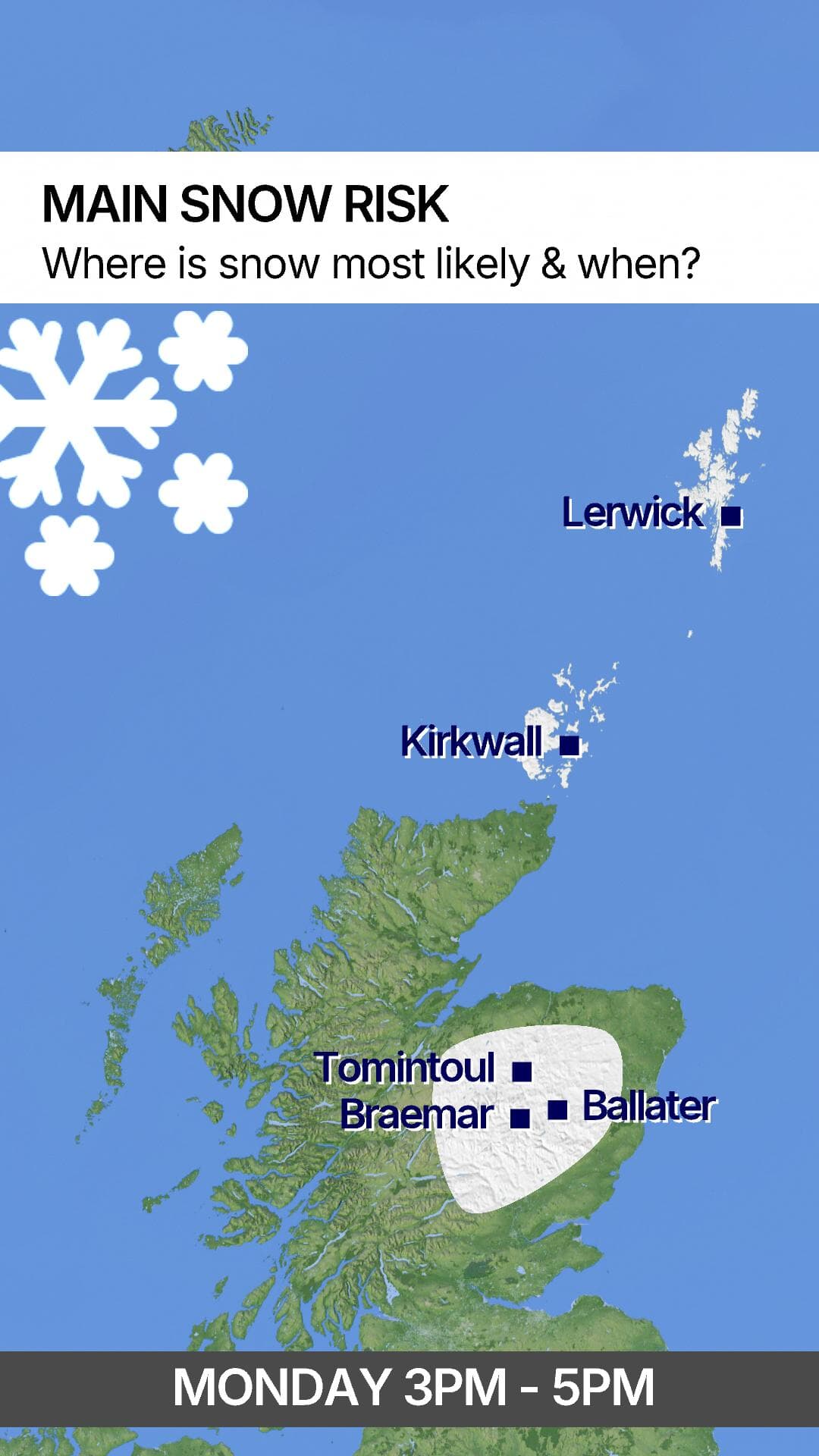
STV meteorologist Sean Batty said snow is most likely to affect the Northern Isles, Lewis and Harris
the north Highlands, Moray, and Aberdeenshire. There will be a little snow on high ground in Fife, Lothians and Borders.
 STV News
“There are two bands of wintry weather to come through on Monday and into the early hours of Tuesday morning,” Sean said.
“Between 3pm and 5pm on Monday, sleet and snow will move across Moray, Aberdeenshire and Angus – mainly over higher ground.
“Higher routes such as the A93, A939 and A9 could turn quite snowy for a time.”
From 6pm, a more organised band of snow – which could be heavy at times – will move across the north of the country covering Shetland, Orkney, the north Highlands, Skye, Lewis, Harris and North Uist.
“A few centimetres are possible even at low levels away from the coasts,” Sean said.
“2 to 5cm is likely in higher towns and villages and the highest communities, such as Moy, could see more than 5cm.”
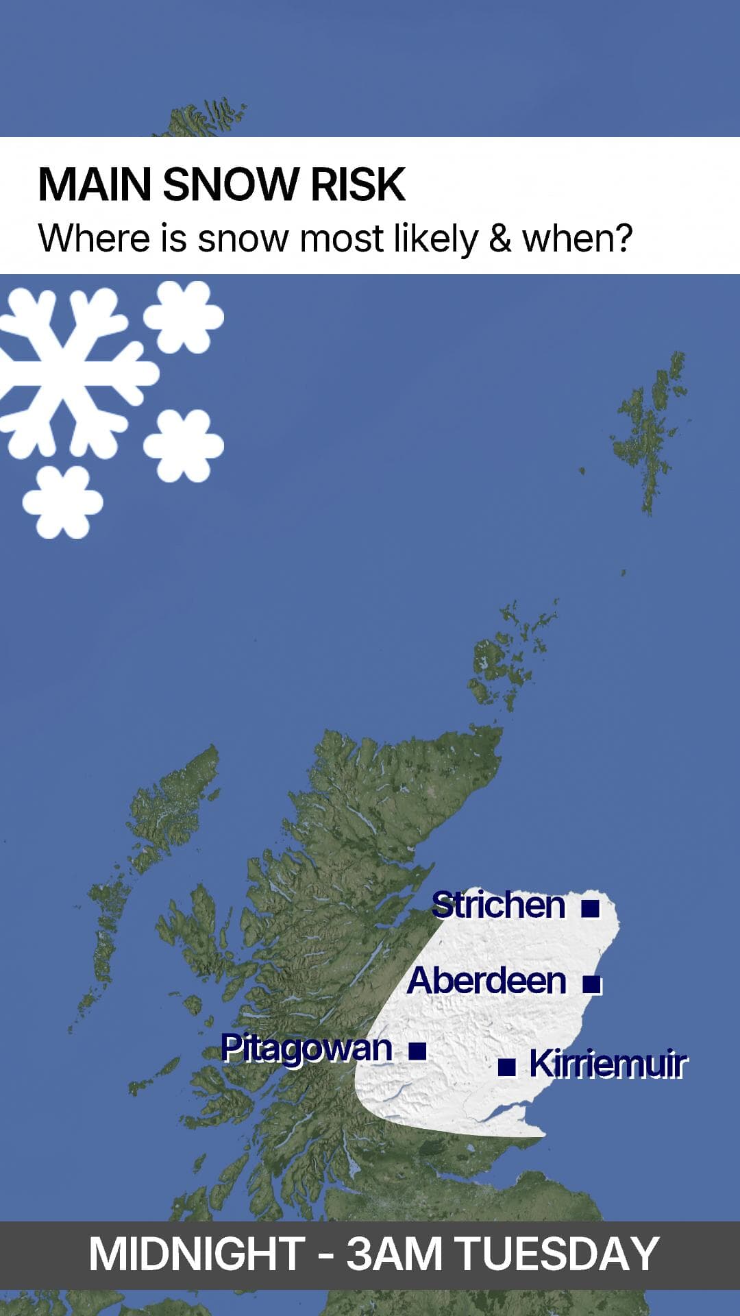
Between midnight and 3am on Tuesday, the snow band pushes southeast into the east Highlands, Moray, Aberdeenshire, Perthshire and Angus.
 STV News
“Snow may again fall heavily, particularly across Moray and Aberdeenshire,” Sean said.
“Similar totals are expected here as in the north of the country earlier in the night. Higher villages including Tomintoul, Dava, Aitnoch, Carbrach, Corgarff and Strathdon could see 5 to 8cm of lying snow.”
As the system moves south, Fife, Edinburgh and the Borders are less likely to see widespread low-level snow.
However, wet ground will freeze, creating icy conditions by Tuesday morning and a little snow could settle over higher spots such as; Glendevon, Upper Yetts, Penicuik, and the higher ground around Gifford and Garvald.
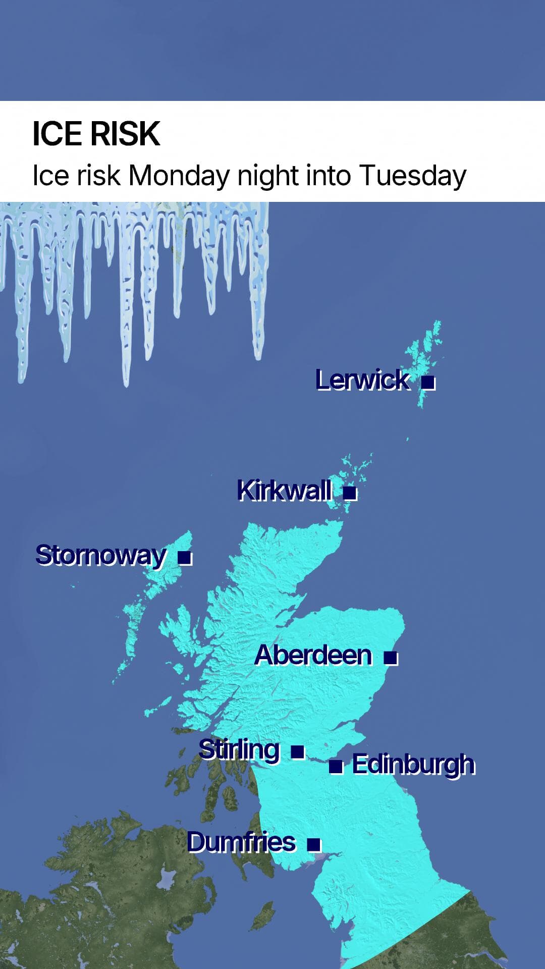
The ice risk is high across most of Scotland for Tuesday morning away from the Ayrshire and Dumfries and Galloway coast.
 STV News
Disruption to roads and railways is likely, as well as slips and falls on icy surfaces.
A few isolated lightning strikes are possible, the Met Office has warned.
Strong winds are also likely during Monday evening and night, with gusts reaching up to 60mph in more exposed areas.
The Met Office has advised the public to leave earlier than usual to reduce the risk of accidents caused by rushing.
Pedestrians should stick to pavements along main roads, which are likely to be less slippery.
Further ahead forecast

Insight Sean Batty STV meteorologist
Tuesday itself, as well as Wednesday and Thursday looks largely dry and bright for most of the country, but still cold.
Ice could still be a risk with a daily thaw of any lying snow and then a refreeze by night.
Friday sees a return to wind and rain along with milder conditions for the weekend – possibly the mildest weather for weeks.
Follow STV News on WhatsApp
Scan the QR code on your mobile device for all the latest news from around the country