 Fubar News
Key Points
-
 Jack-knifed HGV closes A87 near Loch Alsh
 - Snowgates at the Lecht, A939, and at the Cairn O Mount Road, B974 closed
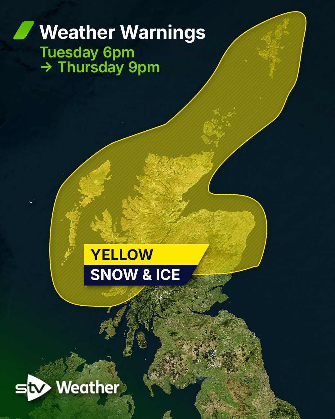
- Yellow snow and ice warning in place until 9pm on Thursday
- A9 at Dunbeath reopens after another lorry jack-knifed
- Ice to hit parts of the Central Belt, Fife, Angus, the Scottish Borders and Dumfries and Galloway
- Chance of thundersnow hitting parts of the country remains
Dozens of schools were closed and roads were disrupted as a cold snap grips Scotland this week.
In Aberdeenshire, 19 schools were closed and 20 in the Highlands were forced to shut on Wednesday. Several nurseries in Shetland and Moray also closed due to bad weather.
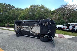
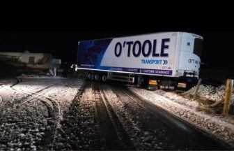
The Highland Council said the A87 at Ardelve via Conchra and Allt na Sugh and Sallachy to Killilan Primary School was closed due to a jackknifed lorry.
Drivers are being urged to take care, with no diversions available.
On the A9 at Dunbeath, an HGV also jack-knifed early on Wednesday morning, with the road reopening in the afternoon.
 Traffic Scotland
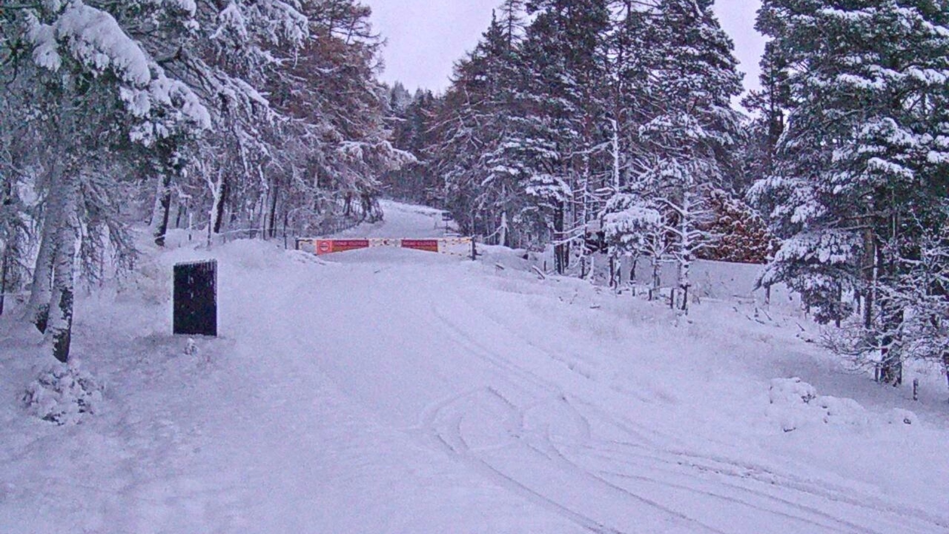
Snow gates at the Lecht on the A939 and at the B974 Cairn o’ Mount road were also closed.
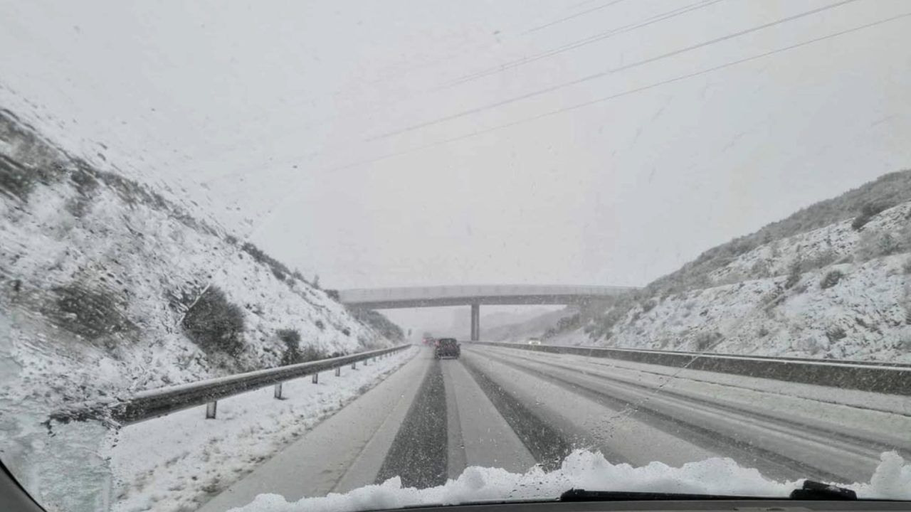
BEAR Scotland said dozens of gritters will be out in force across Scotland’s roads on Wednesday.
A yellow snow and ice warning came into force across Northern Scotland, including the Western Isles, Orkney and Shetland and Aberdeen, from 6pm on Tuesday and will remain in place until 9pm on Thursday.

Another alert saw ice hit parts of the Central Belt, Fife, Angus, the Scottish Borders and Dumfries and Galloway from 4pm on Tuesday until 11am on Wednesday.
The Met Office said rain and hill snow, followed by clearing skies, will lead to the risk of icy patches while frequent snow showers are expected, with up to 20cm of snow likely in higher ground areas.
 STV News
Overnight showers and low temperatures will bring the risk of ice, especially in the north. There is a likelihood of some icy patches on untreated roads, pavements and cycle paths. The public has been warned to take care in case of injuries from slips and falls on icy surfaces.
Snow is expected on hills above 300 metres. Meteorologists said there could be as much as 10cm of snow on high ground.
The public has been warned to take care in case of injuries from slips and falls on icy surfaces.
Met Office chief forecaster Neil Armstrong said: “Cold Arctic air from the north is firmly in charge of the UK’s weather, bringing the first notable cold snap of this autumn and giving an early taste of winter weather.
“As a result, winter hazards are likely through the next few days, with snow and ice a particular hazard, and the coldest conditions likely on Wednesday and Thursday.
“Wintry showers will affect areas exposed to the brisk northerly wind, in particular Northern Ireland, south-west Wales, south-west England, north-east England and across the northern half of Scotland.
“Whilst not all places will see lying snow, where showers are most frequent accumulations of 2-5cm will be possible. On higher ground in Scotland 15-20cm could accumulate and potentially as much as 15-25cm over the North York Moors and Yorkshire Wolds.”
Chance of thundersnow
There remains a chance of thundersnow hitting parts of the country, with snow and lightning forecast.
The natural phenomenon is possible in places where the upper air is coldest, allowing for some tall thunderclouds to form.
STV News Meteorologist Sean Batty said: “If there will be any in the coming days, then it’s most likely to occur in some of the heavier showers across Shetland, Orkney, the north Highland coast, as well as Moray and north Aberdeenshire – where the showers stream straight in off the sea.
“The Northern Isles is the most common area for this weather phenomenon, due to normally being the place with the coldest air – although when deep cold air spills further south this can occur anywhere.”
Follow STV News on WhatsApp
Scan the QR code on your mobile device for all the latest news from around the country