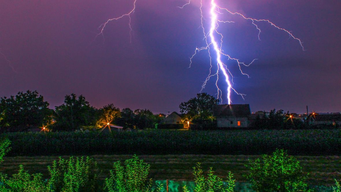
The Scottish Government’s emergency committee has been convened after an amber weather warning was issued for thunderstorms.
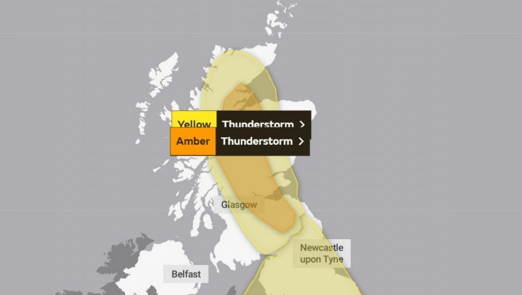
The Met Office forecasts heavy rain and storms through the centre of mainland Scotland, with an amber warning, the second most serious alert, in place for thunder until 10pm on Tuesday.
A yellow warning is also in place for a wider swathe of the country, but most coastal areas in the east and west are again expected to miss the worst of the weather.
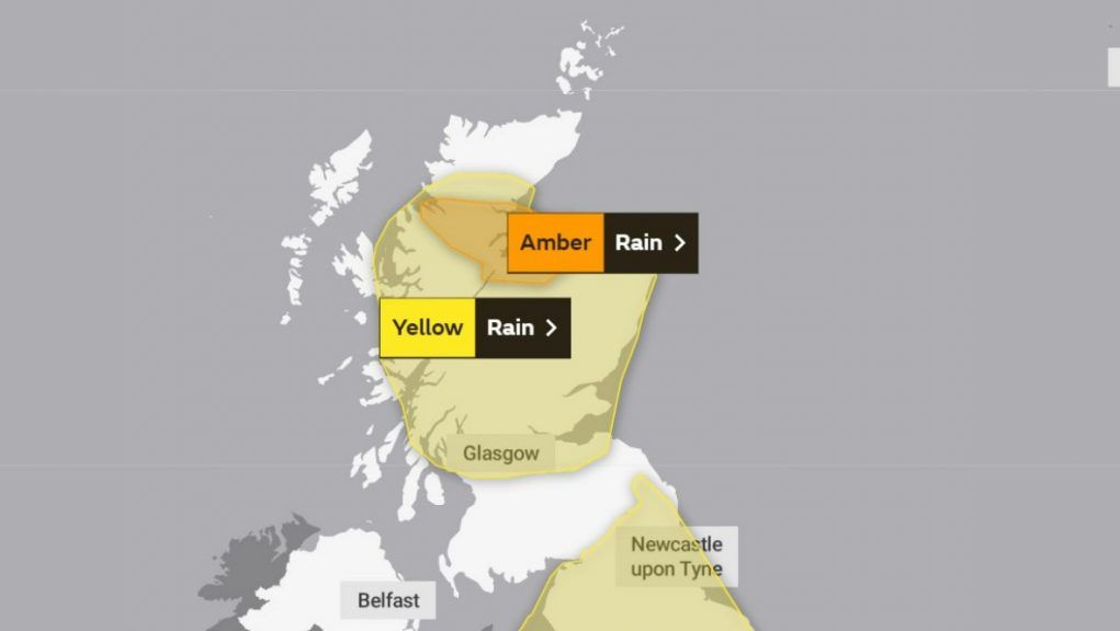
An amber warning for rain will also be in effect until 6am tomorrow in the north, while a yellow warning for downpours will also last until the same time, taking all but the far north east, far north and far west of the country.
The Scottish Government Resilience Room (Sgorr) has been convened to respond to the alert and ensure preparations are in place.
Deputy First Minister John Swinney warned Scots against flooding, saying: “The decision by the Met Office to issue the amber warning for thunderstorms signals a potentially damaging and dangerous risk of flooding in some areas.
“Flooding could happen quickly, even in areas not usually prone to flooding.
“Some communities might become cut off if roads flood, and power cuts might occur.
“Please take extra care if you are out and about, do not attempt to walk or drive through flood water, avoid camping near watercourses and ensure water conditions are safe if spending time in the water.
“The Scottish Government is in close contact with local authorities and the emergency services to ensure people in the affected areas receive the latest information, advice and support where needed.”
STV meteorologist Sean Batty said: “For weeks most of the country has basked in hot sunshine, but as is usually the case this will go out with a bang.
“This happens because the heat builds under high pressure, which acts like a big lid over the country limiting vertical convection – which basically means only small clouds can form.
“Once this weather starts to shift, the lid comes off and allows all the heat that’s built up bubble up into huge clouds which bring thunderstorms, and that’s exactly what’s happening now.”
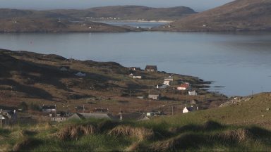
Throughout Tuesday afternoon and evening, thunderstorms will develop with the main focus down the middle of the Highlands, Perthshire, western Fife, Falkirk, Clackmannanshire, Edinburgh, West Lothian and the Borders.
Sean said: “This is where we have an amber weather warning in force.
“One of the reasons intense showers after dry conditions can be a problem is because the sun has spent weeks baking the ground solid.
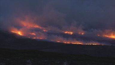
“This means that it’ll take longer for rain to soak into the ground, so as you can imagine, a huge amount of rain in a short period means the rain has nowhere to go and runs towards low areas.
“This is the sort of situation that brings those images of underpasses flooded and the usual roads blocked by floods.”
Sean added: “On Wednesday it’s not so much thunderstorms, but persistent rain that’ll bring flood issues.
“This is most likely in the amber warning area stretching across Wester and Eastern Ross, Inverness, Nairn and Elgin.
“As much as 50-60mm may fall in some areas of Moray and the Highlands tomorrow and perhaps in excess of this in the hills.
“That means that there is a possibility of some locations getting near a month’s worth of rain on Wednesday alone.
“For those worried that summer is over, well don’t be, because our seasons don’t go through clean transitions, and there’s still several weeks left where hot and sunny conditions can redevelop.
“For now though it is looking changeable, although quieter weather returns for the weekend.”
Tuesday weather alerts
Amber warning: From 12pm until 10pm on Tuesday.
Yellow warning: From 12pm until 11.59pm on Tuesday.
Wednesday and Thursday weather alerts
Amber warning: From 6am on Wednesday until 6am on Thursday.
Yellow warning: From 12am on Wednesday until 6am on Thursday.
Stay safe in thunder and lightning
Before the thunderstorm
- Lightning can cause power surges, so unplug any non-essential appliances if not already using a surge protector.
- Seek shelter if possible. When you hear thunder, you are already within range of where the next ground flash may occur. Lightning can strike as far as ten miles away from the centre of a storm.
During the thunderstorm
- Telephone lines can conduct electricity so try to avoid using the landline, unless in an emergency.
- If outside, avoid water and find a low-lying open place that is a safe distance from trees, poles or metal objects.
- Avoid activities such as golf, rod fishing or boating on a lake.
- Be aware of metal objects that can conduct or attract lightning, including golf clubs, golf buggies, fishing rods, umbrellas, motorbikes, bicycles, wheelchairs, mobility scooters, pushchairs, wire fencing and rails. If you are in a tent, try to stay away from the metal poles
- If you find yourself in an exposed location it may be advisable to squat close to the ground, with your hands on your knees and with your head tucked between them. Try to touch as little of the ground with your body as possible, and do not lie down on the ground.
- If you feel your hair stand on end, drop to the above position immediately.
After the thunderstorm
- Avoid downed power lines or broken cables.
- If someone is struck by lightning, they often suffer severe burns. The strike also affects the heart, so check if they have a pulse.
Driving in a thunderstorm
- If you are caught out in thunder and lightning it is advised that you wind up the windows and stay inside your car. This is because in the vast majority of cars with a metal roof and frame, the frame will act as a conductive Faraday cage, passing the current around the passengers inside and onto the ground.
- Soft-top convertibles, with their fabric roofs, are the most at risk and could catch fire if struck by lightning
- Be aware that current can travel through other parts of many modern cars, including GPS and radio systems. Cars with metal interior handles, foot pedals and steering wheels can also carry current
- Cars can be damaged both internally and externally by lightning strikes
- Thunderstorms can also bring a risk of sudden gusty winds. Those most at risk would include cyclists, motorcyclists and high-sided vehicles.
- Remember to give vulnerable road users including cyclists, motorcyclists and pedestrians more room than usual. They are more likely to be blown around by side winds – always keep a safe distance.
- Keep your speed down. Lowering your speed will lower the distance you travel when buffeted around by the wind.
- Hailstorms can be extremely dangerous to drive in – reducing your ability to see and be seen, as well as causing damage to your vehicle. If hail is severe, stop and pull over to a safe place and remain inside the vehicle.
For more advice, click here.
Follow STV News on WhatsApp
Scan the QR code on your mobile device for all the latest news from around the country