 STV News
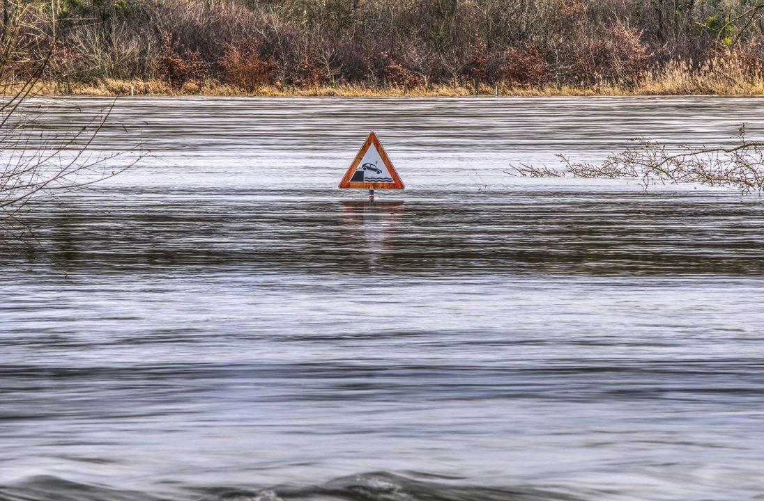
The Scottish Environmental Protection Agency has issued a warning to most of Scotland to prepare for flooding.
Those living in the North East, Tayside, Borders, Highlands, and Islands have been urged to brace for disruption caused by coastal flooding and persistent heavy rain from Thursday evening onwards.
SEPA also stated that the situation is likely to worsen over the weekend in some areas.
Adverse weather caused the A90 at Boddam and Lonmay to close in both directions due to a deluge of water. It has since been reopened to motorists.
Scotland is also set to be hit by strong winds this weekend, with the Met Office issuing a yellow weather warning for wind from 3am on Sunday, October 20, until 12pm on Monday, October 21.
Where are the amber flood alerts in Scotland this week?
On Thursday, a number of areas were issued amber alerts for:
- Aberdeenshire and Aberdeen City, Caithness and Sutherland, Central, Dumfries and Galloway, Dundee and Angus, Easter Ross and Great Glen, Fife, Findhorn Nairn Moray and Speyside, Orkney, Shetland, Skye and Lochaber, Tayside, Wester Ross, Western Isles.
On Thursday, flood warnings are in place for:
- Montrose, Stonehaven, Rosehearty to Fraserburgh, Spey Viaduct to Spey Bay, Findhorn to Lossiemouth, Stornoway. Ardmore to Loch Carnan

Insight Sean Batty STV meteorologist
Over the past few days, computer models have been consistently predicting the development of a low-pressure system in the Atlantic, which looks set to intensify into a storm likely to impact Scotland this weekend.
It’s looking highly likely this is going to be named, and I expect warnings will be issued as we get closer to the weekend once there’s a bit more detail on track and intensity of the system.
The UK storm season officially resets in early September, so if the storm is named, it will be Ashley – the first of the season. The last named storm to affect the UK was Lilian in August, which brought heavy rain to the Borders and wind gusts reaching 60 mph on the mountain tops.
This will be the first spell of proper autumn gales for the country with most of the country experiencing a period of strong winds through Sunday and into Monday. Models are currently indicating that wind gusts could reach 70-75 mph in the most exposed parts of the Hebrides and Northern Isles.
This upcoming storm will mark the first significant autumn gales of the year, with much of the UK set to experience strong winds through Sunday and into Monday. Current models suggest gusts could reach 70-75 mph in the most exposed areas of the Hebrides and Northern Isles. Elsewhere, gusts of 50-60 mph are expected, and if the storm track holds, we could see a spell of particularly strong gusts sweeping across the central belt on Sunday night.
Adding to the potential hazards, we’re currently in a period of spring tides, when high tides are higher than usual. Combined with the strong winds, this increases the risk of coastal flooding and large waves along the coast.
As I say, the details of this system are still being watched, but expect to see some warnings in the coming days, and expect disruption if you’re planning a ferry trip on Sunday or Monday.
Follow STV News on WhatsApp
Scan the QR code on your mobile device for all the latest news from around the country