We’re only four weeks into 2026, and already the Northern Hemisphere has had a remarkable run of extreme winter weather.
In Russia, parts of the Kamchatka Peninsula have seen nearly two metres of snow fall in just two days – an extraordinary accumulation even by local standards.
Japan has also been in the grip of severe winter conditions. Snow depths have reached 250cm in Uonuma, while Asahikawa in Hokkaido plunged to –29C, marking one of the coldest spells in recent years.
Across the Pacific in Alaska, life-threatening wind-chills hit near record levels and some areas, including Anchorage, have recorded their deepest January snow on record.
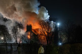
Meanwhile, a vast and historic winter storm swept across the United States just days ago, placing warnings over almost half the country and affecting more than 100 million people. Heavy snow and ice caused widespread disruption, and even southern Florida experienced some of its coldest weather since 2010.
In southern Europe, Storm Joseph brought extreme rainfall and flooding to parts of Spain, while mountains in the north of the country saw record-breaking snowfall – with 142cm recorded at Núria.
Further north, Sweden recorded a low of –41C a few weeks ago. While such temperatures are not unheard of, what has stood out is the persistence of the cold across Scandinavia. In Lapland, temperatures remained below –30C for two consecutive weeks, making it the fourth-longest cold spell in 148 years.
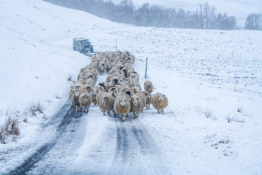
Closer to home, Scotland has seen exceptional snow depths on mountain tops, with some ski centres quite literally having to dig their buildings out of the snow.
So what’s going on?
At first glance, this all sounds like the opening chapter of a new ice age. You’d be forgiven for thinking: “Aren’t we supposed to be warming?”
And the answer is – yes, we are.
Here’s the balance. While much of the Northern Hemisphere has endured bitter cold, parts of the Arctic have been up to 20C warmer than average! Arctic sea ice extent currently sits at around 12.5 million square kilometres, a record low for the time of year and roughly 1.5 million square kilometres below the 1980s average.
This feeds into a vicious feedback loop: less ice means less sunlight reflected back into space, leading to further warming – and even more ice melt.
What’s happened this winter is that the cold air normally locked over the Arctic has been displaced southwards into Europe, Asia and North America. During winter, when the Arctic enters 24-hour darkness – the polar night – a fast-moving ribbon of air high above the pole (the polar vortex) usually keeps the coldest air contained.
However, in recent winters this circulation has shown a tendency to weaken or break down more often. This winter, it has struggled to fully establish itself. As a result, the “ring fence” has been leaky – allowing bitter Arctic air to spill south, while milder air pushes north into the Arctic to replace it.
On top of that, a warming atmosphere can hold more moisture, meaning both rainfall and snowfall events are now capable of becoming more extreme than they once were.
What’s next for Scotland?
The cold spell that affected Scotland in early January was linked to an earlier breakdown of the polar vortex at the end of December. With another disruption expected in early February, there’s a strong chance of further severe cold outbreaks – and more weather headlines – across the Northern Hemisphere in the weeks ahead.
For now, Scotland sits right on the boundary between deep cold air to the east and milder Atlantic air to the west – a classic no-man’s-land. This setup has allowed weather fronts to stall, blocked from moving east by high pressure over Scandinavia, bringing continued rain to eastern areas that have already seen plenty over the past week.
With cold air never far away, there’s still the potential for more snow in the mountains, particularly across the upper slopes of our ski centres.
While another major cold outbreak later in February looks increasingly likely, where it ends up is still anyone’s guess. That said, many in the west of Scotland will be hoping for at least one decent snowfall before winter draws to a close – though judging by recent weeks, those in Aberdeenshire and Moray may feel they’ve already had more than their fair share.
Follow STV News on WhatsApp
Scan the QR code on your mobile device for all the latest news from around the country