Key Points
-
 Three yellow warnings to hit most of Scotland this week
 - Scotland to experience ‘thundersnow’ in coming days
- Snow showers and icy blast to bring disruption to travel
- Up to 10cm of snow possible across higher parts of Borders and Highlands
- Temperatures could drop to -10C in parts
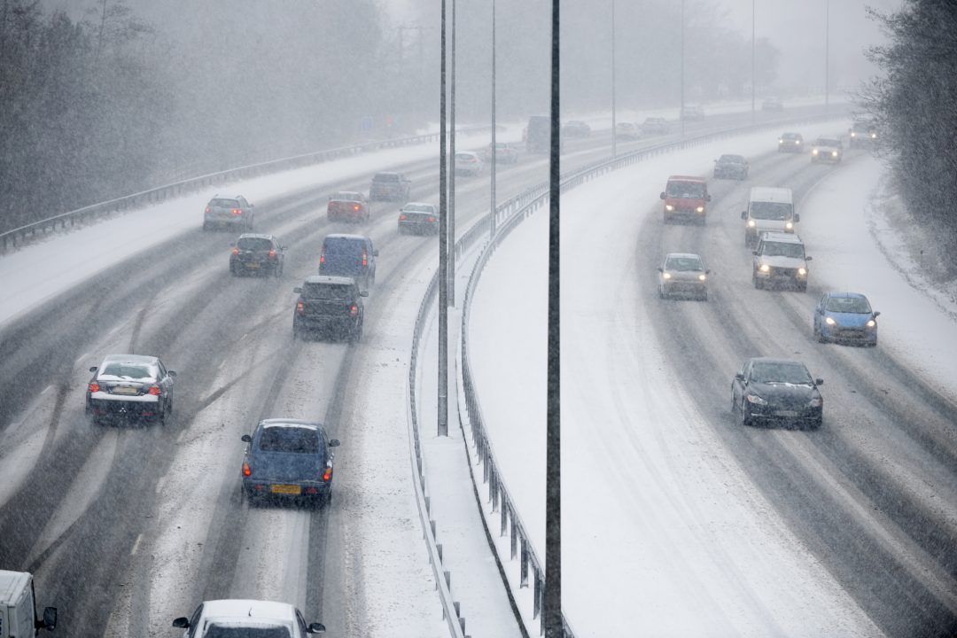
Multiple snow and ice warnings have been issued as wintry weather grips Scotland this week.
The Met Office has issued three yellow weather warnings, covering most of Scotland, as an icy blast hits the country.
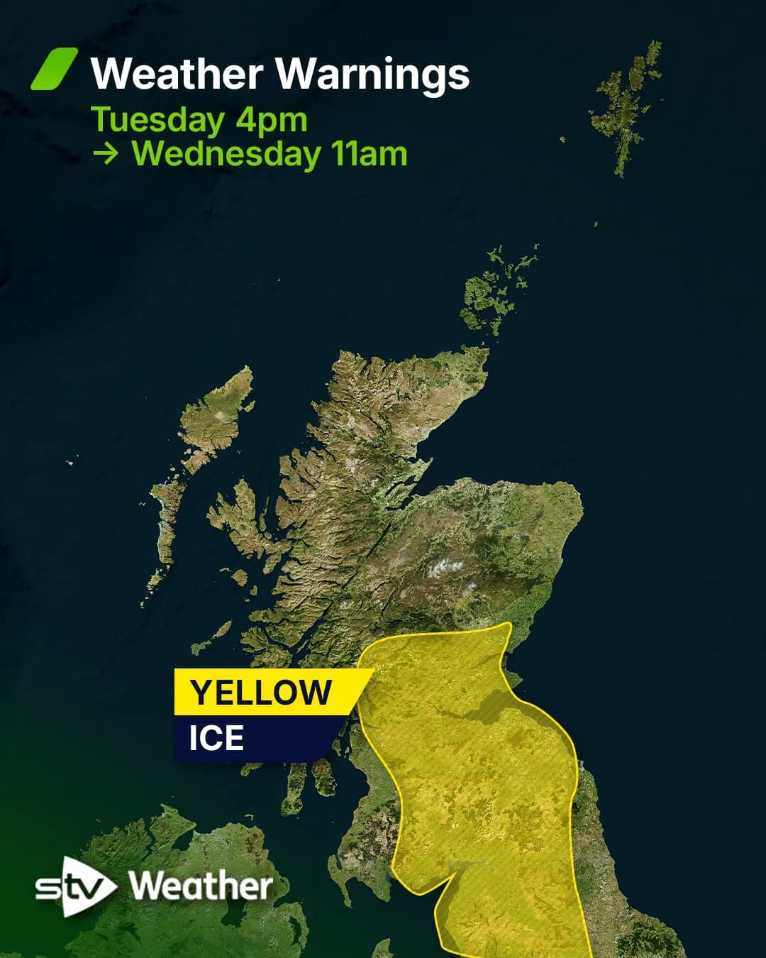
A yellow alert for snow is in place until 6pm on Tuesday for much of the Highlands, Argyll and Bute, Aberdeenshire and Moray, with parts of Stirling, Perth and Kinross and Angus also affected.
Chance of thundersnow
There is a chance of thundersnow hitting parts of the country, with snow and lightning forecast.
The natural phenomenon is possible in places where the upper air is coldest, allowing for some tall thunderclouds to form.
STV News Meteorologist Sean Batty said: “If there will be any in the coming days, then it’s most likely to occur in some of the heavier showers across Shetland, Orkney, the north Highland coast, as well as Moray and north Aberdeenshire – where the showers stream straight in off the sea.

“The Northern Isles is the most common area for this weather phenomenon, due to normally being the place with the coldest air – although when deep cold air spills further south this can occur anywhere.”
The third alert will see ice hit parts of the Central Belt, Fife, Angus, the Scottish Borders and Dumfries and Galloway from 4pm on Tuesday until 11am on Wednesday.
Meanwhile, a snow and ice warning will come into force from 6pm on Tuesday until 9pm on Thursday, covering much of the same areas and extending to the Western Isles, Orkney and Shetland and Aberdeen.
Frequent snow showers are expected, with up to 20cm of snow likely in higher ground areas.
The public has been warned to take care in case of injuries from slips and falls on icy surfaces.
 STV News
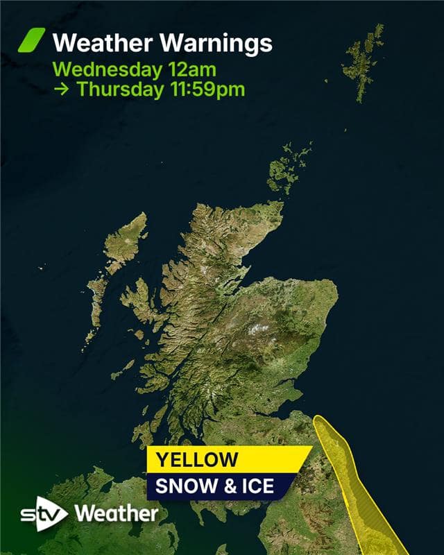 STV News
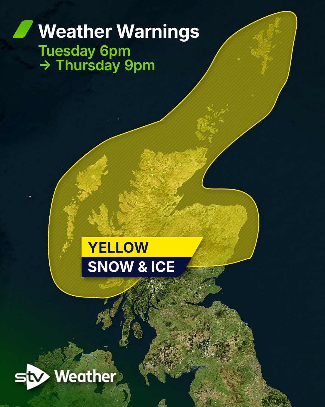 STV News
How much snow is going to fall across the country?
The biggest accumulations will be across the higher parts of the Borders and the Highlands, where 5 to 10 cm is possible.
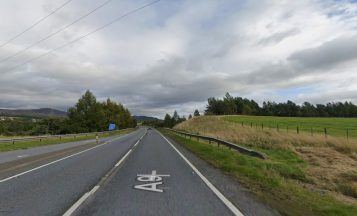
Higher roads such as the A9, A95, A96, A68 and A7 could see several centimetres of snow settle during Tuesday afternoon and evening.
Once this messy mix clears on Tuesday evening, things become more straightforward.
Sunshine will develop across central and southern Scotland, while snow showers continue across the north on Wednesday and Thursday.
These will be heaviest in areas exposed to the northerly flow, including the Northern Isles, Western Isles, Skye, north Highlands, Moray and north Aberdeenshire. East Lothian and the coastal Borders may also catch some flakes – some significant accumulations may develop in some areas.
How to prepare for snow and ice
With the sun so low at this time of year, many streets and roads see no direct sunlight at all, meaning frost and ice can linger right through the day.
The Met Office said: “Keep yourself and your family safe when it is icy.
“Plan to leave the house at least five minutes earlier than normal. Not needing to rush, reduces your risk of accidents, slips, and falls.
“If you need to make a journey on foot, try to use pavements along main roads which are likely to be less slippery.
“Similarly, if cycling, try and stick to main roads which are more likely to have been treated.”
Dr Ron Cook, NHS 24 Executive Medical Director said: “With icy conditions expected, we urge everyone to wrap up warmly and take extra care when outside.
“Cold weather can be particularly challenging for older people, young children, and those with long-term health conditions, so please check on neighbours and loved ones to ensure they have what they need to stay warm and safe.
“Simple steps like wearing sturdy footwear and allowing more time for journeys can help prevent slips and falls.
“Also remember cold air can also make breathing difficult for people with asthma or COPD. Keep your medication handy and try to limit time outdoors during severe cold spells.”
How cold is it going to feel?
STV meteorologist Sean Batty has predicted that most towns and cities will see daytime temperatures around 4C or 5C through much of the week, with nights dipping to around freezing.
Very low temperatures are also on the way.
When the coldest air arrives on Thursday, many areas will fall below zero.
Rural areas will be much colder. Some of the typical cold spots, such as parts of South Lanarkshire, may drop to around –7C, while the south and west Highlands could fall to about –10C, especially in glens where lying snow will help temperatures tumble even lower.
The coldest night since March was recorded on Saturday when temperatures dropped to -7C in Tulloch Bridge in the Highlands.
Follow STV News on WhatsApp
Scan the QR code on your mobile device for all the latest news from around the country