 NASA
NASAMeteorologists believe the incoming Storm Amy, which formed in the wake of two hurricanes, could be a weather bomb.
On Friday at 5pm, the first storm of the new season will hit Scotland, with weather warnings in effect for the entire country until midnight on Saturday.
Storm Amy will bring heavy rain and gusts of up to 100mph within the worst-affected areas in the north-west of the country.
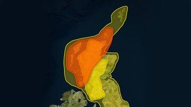

An amber alert covers much of the Highlands, Orkney, and Shetland, as well as parts of Argyll and Bute and Moray, and remains in force until 9am on Saturday.
There is a risk of disruption to travel across rail, ferry and air.
Forecasters are warning of a danger to life from flying debris, large waves and beach material being thrown onto sea fronts, coastal roads and properties.
What is the Fujiwara effect?
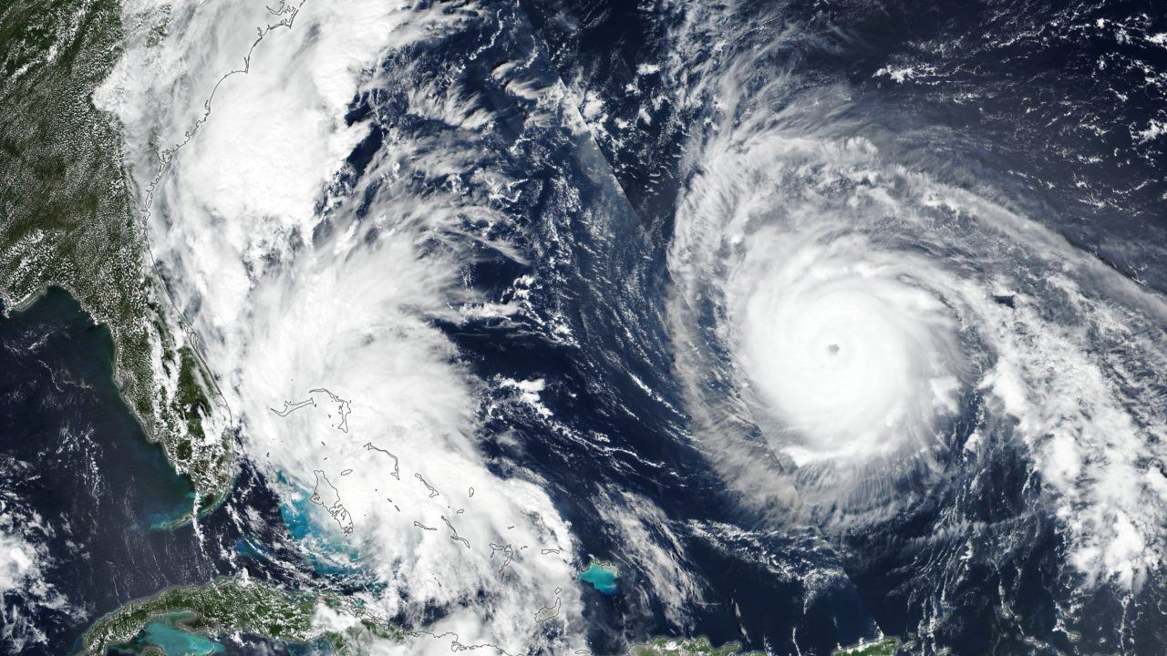
Experts from the University of Reading have described the storm, which has developed in the wake of Hurricane Humberto churning close to Hurricane Imelda, as “quite remarkable”.
The natural phenomenon is known as the Fujiwara effect and occurs when two nearby cyclonic vortices move around each other at a close distance.
Imelda, which is a tropical cyclone, and category five hurricane Humberto are unusually close together over the Atlantic.
They are less than 600 miles apart placing them among the top ten closest pairs of Atlantic storms in the past 60 years.
This is the second such storm of the season which is a rare occurrence and has not been seen back-to-back since 1932.
Forecasters believe Storm Amy has the potential to develop into a weather bomb.
What is a weather bomb?
A weather bomb is the unofficial term for when a storm intensifies rapidly, which means the central pressure falls by about 24 millibars in 24 hours – it is also known as explosive cyclogenesis.
Forecasts suggest Storm Amy could deepen by around 40 millibars in the 24 hours before it hits the UK coastline.
Experts believe the storm may be “fast-developing and potentially dangerous” with western Scotland to be hit the worst by heavy rain.
Dr Jess Neumann said: “Storm Amy is forecast to bring strong winds and potentially heavy rain which could damage buildings and infrastructure, lead to localised flooding and cause severe travel delays.
“Parts of the UK which are not expected to be directly hit by Storm Amy, such as the south east will also feel the effects with some strong winds (40-50mph) and heavy rain causing disruption.
“In parts of northern England and Scotland, recent rainfall over the past few days increases the chance of flooding and associated hazards such as landslides.”
Follow STV News on WhatsApp
Scan the QR code on your mobile device for all the latest news from around the country