Latest updates
-
 ScotRail has cancelled all rail services from 7pm
 -
 Storm Jocelyn comes just days after Storm Isha wrecked havoc
 -
 The Met Office has put amber and yellow weather warnings in place
 -
 Hundreds remain without power after supplies were disrupted on Sunday
Scotland is set to be battered by the third named storm of the year as gusts of up to 80mph are expected to hit coastal areas.
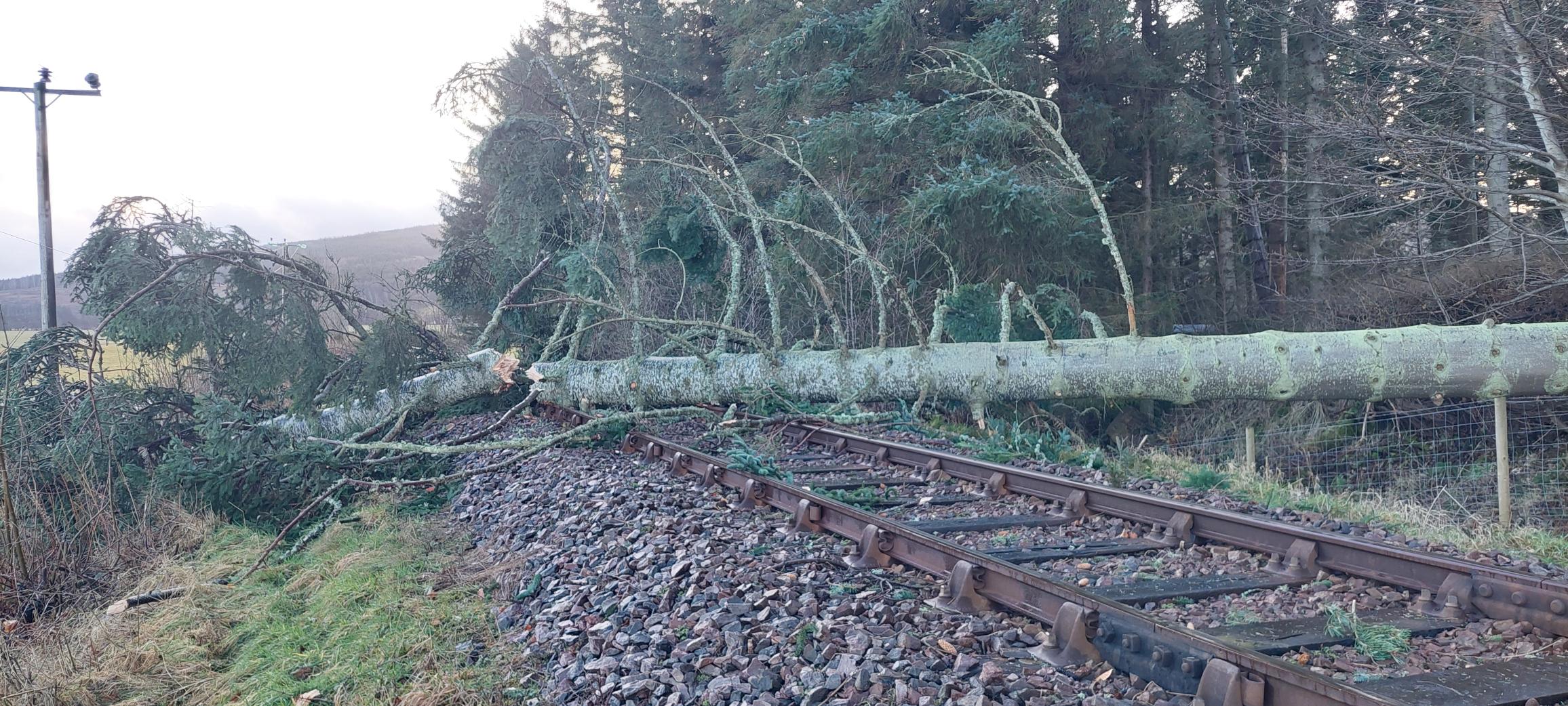
Storm Jocelyn comes just days after Storm Isha wrecked havoc across the country, with residents left without power, airline passengers diverted during “frightening” flights and the rail network forced to cancel a number of trains.
ScotRail has cancelled all rail services from 7pm on Tuesday due to the storm, and the operator said it could be some time before the network reopens.
Each route will have to undergo a safety inspection before trains are able to operate, which means there will be no rush hour services on Wednesday.
Hundreds of people in Falkirk face a third night without power after a tree fell and crushed a substation.
 Network Rail
The Met Office has put an amber warning in place for parts of Aberdeenshire, Moray, the Highlands, the Western Isles, Orkney, Argyll and Bute and North Ayrshire as the storm rolls in.
Due to come into effect from 6pm on Tuesday, the amber warning follows a yellow warning which came into place two hours earlier at 4pm and covers the whole of Scotland.
Gusts of 80mph could be experienced in exposed areas, with 40-50mm of rain possible over higher ground, forecasters said.
The Met Office warned of a “danger to life” amid large waves and strong gusts in coastal areas, with debris also posing a risk.
Met Office chief meteorologist Steve Willington said Storm Jocelyn, named by Met Eireann, could cause more disruption than Storm Isha.
He said: “Although this system will be a step down relative to Storm Isha, with the damage and clean-up still under way, we could potentially see more impacts from Storm Jocelyn.
“Wind gusts are expected to reach 55 to 65mph across north-western Scotland while there is potential for winds to reach 75 to 80mph in a few places, in particular exposed parts of the Western Isles and coastal north-west Scotland early on Wednesday morning.”
Martin Thomson, national operations manager for resilience at Transport Scotland, said: “Across the wider network, we can expect to see more delays and cancellations with ferries, flights and rail from Tuesday into Wednesday morning.”
Liam Sumpter, route director for Network Rail Scotland, said Storm Isha caused “a huge amount of damage” and teams have been working “around the clock” to remove fallen tress and debris, and repair damaged infrastructure.
He went on: “While we are continuing to reopen routes when it is safe to do so, we unfortunately expect even more disruption in the coming days as Storm Jocelyn arrives in Scotland.
“If you’re planning on travelling by train this week, please check the status of your journey with your train operator.
“We’re also urging lineside neighbours to make sure that garden furniture and equipment is secure as in high winds, this can blow on to the railway, causing damage and disruption.”
Avanti West Coast urged passengers not to travel north of Preston after 3.30pm on Tuesday.
Services to and from Scotland are expected to be suspended until at least noon on Wednesday.
Road journeys are also likely to be affected by the storm.
RAC spokesperson Alice Simpson said: “With so much heavy rainfall and debris on the roads, driving conditions will be very challenging, especially across northern parts of the country where the weather is at its worst.
“Visibility will be severely reduced due to the spray from lorries and other large vehicles, and the amount of water on the roads will increase stopping distances.
“We urge drivers to consider postponing their journeys in these areas if at all possible.
“We also suggest drivers avoid parking underneath or near to trees.”
Follow STV News on WhatsApp
Scan the QR code on your mobile device for all the latest news from around the country


