Everyone loves a good “Snow on the way” headline – which is why you see it pop up so often through the winter months.
It’s attention-grabbing, exciting… and often misleading.
It’s also guaranteed to fill the Facebook comments with people who haven’t actually read the article.
But where do these stories come from? Surely there’s some truth behind them?
Well, yes – they’re not complete nonsense – but let me explain why they appear time and time again.
 Wetterzentrale.de
Weather forecasters use computer models to look at long-term trends and see what might be coming in the weeks ahead.
But the keyword here really is trends. Once you look beyond a few days, those models start to diverge and show very different possibilities.
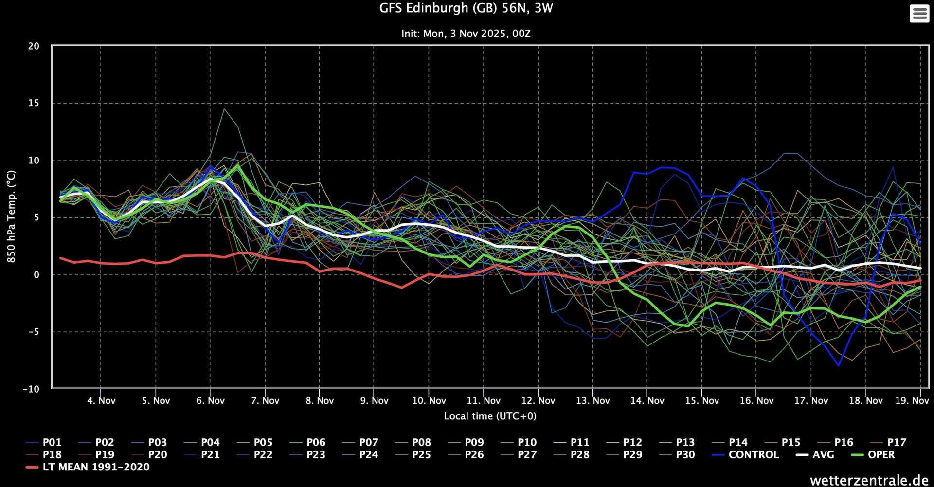
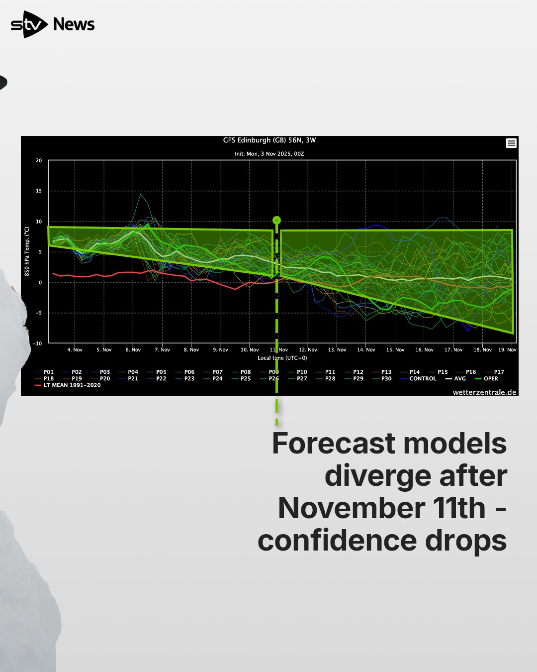
Take today’s computer models, for example. This graph from the GFS (one organisation’s model family) shows lines representing different forecasts.
 STV News
Up until around November 11, they’re all fairly similar – but after that, they scatter all over the place. That scatter means confidence beyond November 11 becomes low.
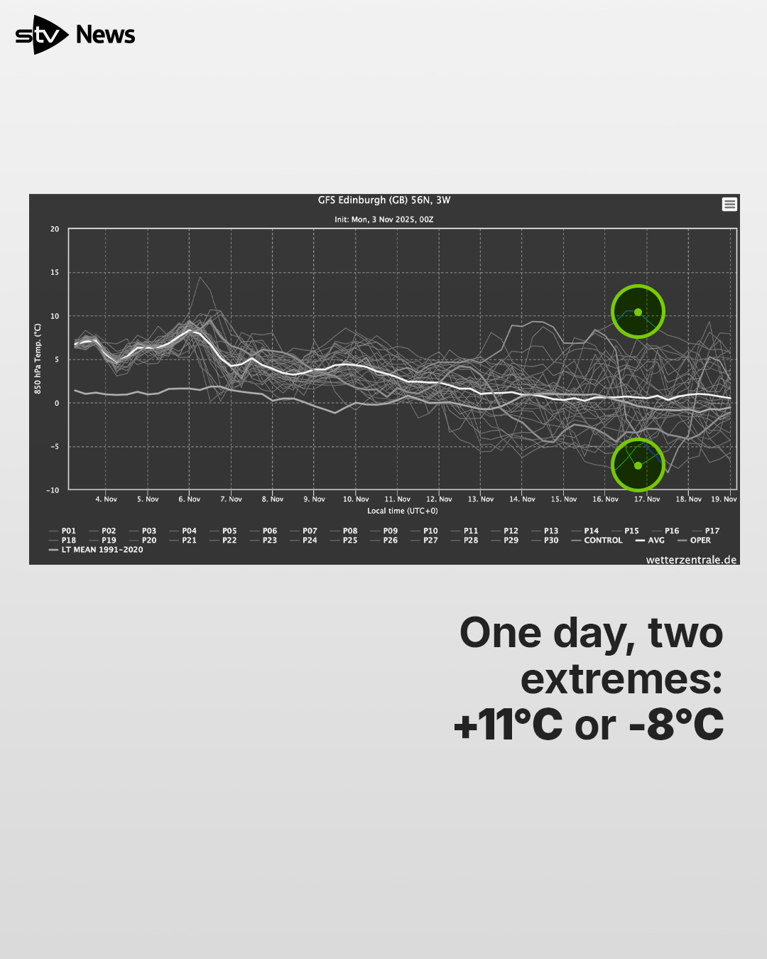
Each of those lines is a possible outcome. We could pick any one of them and build a forecast for the end of the month. Look at November 16, for instance – one model shows an airmass temperature of +11C, while another shows -8C. That’s a whopping 19-degree difference for the same day.
 STV News
For Edinburgh, that could mean 14°C in the afternoon… or 2°C. So you can see why things get tricky the further out you go.
And here’s where it gets misleading; I could take those model extremes and write two completely different headlines.
Pleasant warm-up expected mid-month
Or
City to shiver in mid-month freeze with snow
Two completely opposite stories – and both technically come from the same set of data.
Hopefully now you see why there’s some truth in those dramatic headlines, but also why they’re not the whole story.
So what should we do?
First, never believe online forecasts that claim to know the weather for a specific day more than a week in advance. Stop worrying about why the forecast for your April wedding keeps changing – it will, because the models update every six hours and shift each time.
The same goes for Christmas Day or that holiday in Majorca in five weeks – stop fretting.
We’ll never be able to predict specifics that far in advance.
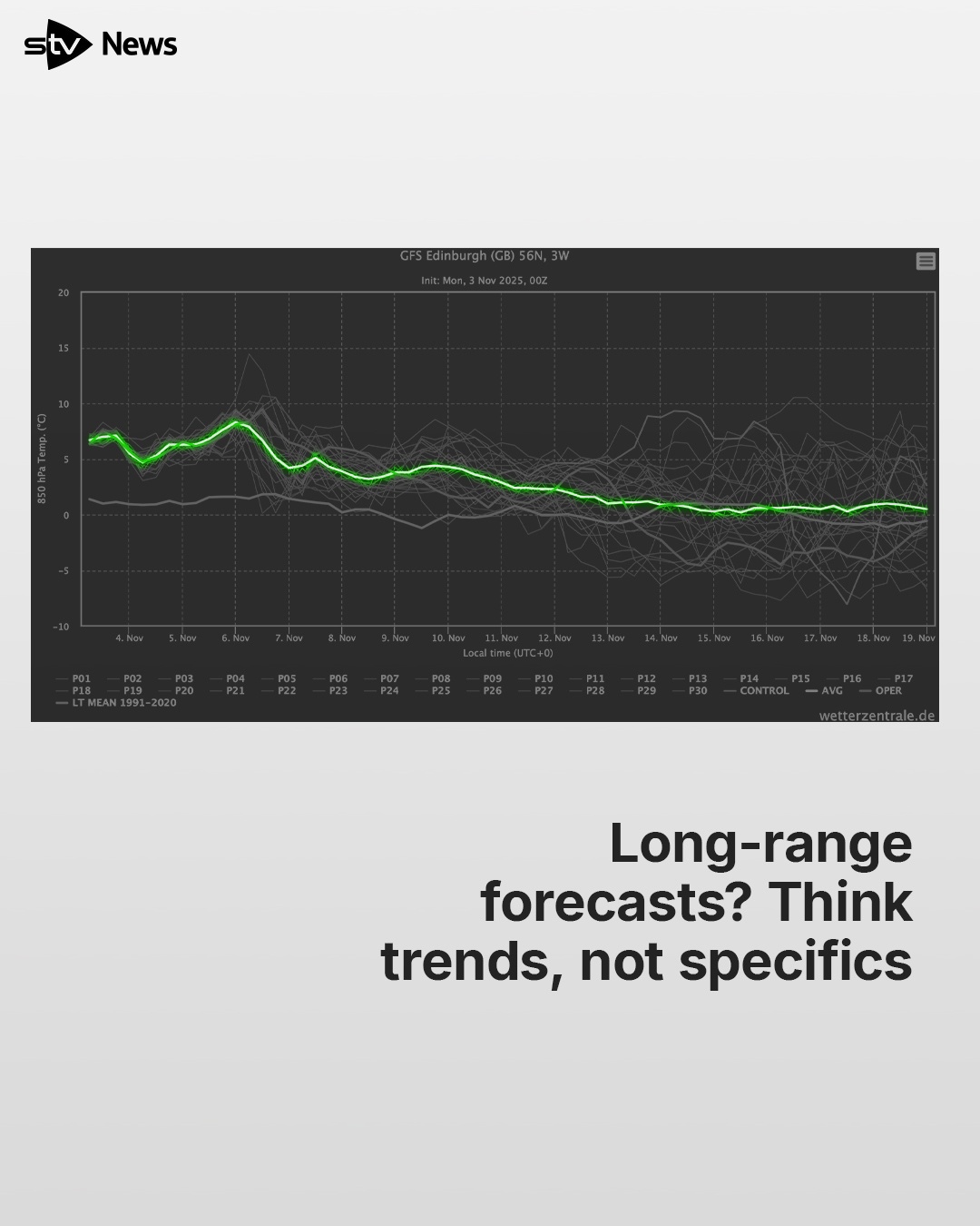
What we can do is look at trends. Back on that graph, you’ll notice a white line – that’s the average, which smooths out the chaos from all those different model runs.
 STV News
It gives us a sense of whether things might generally warm up or cool down. Right now, it suggests a little warm-up in the short term, then a gradual drop later in the month – but still above average for November overall.
We also look for clusters – when several models start showing the same pattern, that’s a sign a trend might be emerging. At the moment, it’s roughly half-and-half between warmer and cooler outcomes – meaning, really, it could go either way.
So next time you see headlines shouting about a “big freeze” or “heatwave” remember this: someone’s just picked one possible model outcome and run with it.
We’ll never do that. And if I ever do mention a long-range possibility, I’ll always make it clear – it’s just one potential outcome.
That said, I’ll admit it, I do love snow. So the minute it looks like it’s on the way, I’ll be shouting it from the rooftops.
Follow STV News on WhatsApp
Scan the QR code on your mobile device for all the latest news from around the country