 Network Rail/X
A train has struck a trampoline and fallen trees have caused travel chaos across Scotland during Storm Bram.
The Met Office amber weather warning was extended on Tuesday with more travel disruption expected as the storm brings wind gusts of up to 90mph.
Weather warnings started coming into force at 6am on Tuesday. Two yellow wind warnings are in place from 12pm covering the whole of Scotland apart from Shetland.
An amber warning for wind comes into force at 4pm for the Highlands, the Western Isles, and Argyll and Bute, lasting until 3am on Wednesday.
Yellow wind warnings remain in place across much of the country through to Wednesday.
On Tuesday evening, Network Rail said a train struck a trampoline on the line south of Perth.
A statement read: “The train is back on the move, but if you live next to the railway, please help us by securing garden furniture, sheds and trampolines so we can keep services moving.”
Network Rail also said a fallen tree was causing overhead wire damage near Whitecraigs on the Glasgow Central to Neilston line.
ScotRail said on X: “Network Rail are responding to reports of a tree falling onto the overhead lines near Whitecraigs.
“Services on our Glasgow Central – Neilston line will be cancelled, delayed or revised until this tree has been removed, the damage inspected and repairs carried out.”
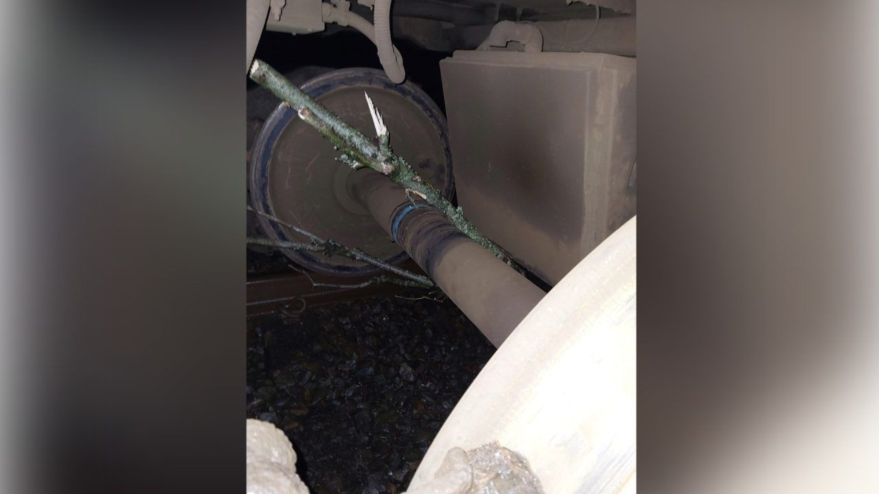
Additionally, the operator said two fallen trees on the line between Kilmarnock and Carlisle via Dumfries, one at Thornhill and one at Eastriggs, were causing disruption.
One of the trees is trapped underneath the train with engineers en route.
Rail services between Fort William and Mallaig were suspended from 4pm and between Dingwall and Kyle of Lochalsh from 5pm due to “extreme winds”.
Speed restrictions are in place on other routes. Passengers are being urged to plan ahead.
Glasgow Airport said a number of arriving and departing flights are experiencing delays or diversions.
A statement read: “We advise passengers, as well as those collecting friends and family, to check the status of their flight with airlines.”
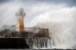
Strong winds and heavy rain brought down power lines, leaving many homes and businesses without electricity.
Engineers have been deployed to assess the damage, but the duration of restoration efforts remains unknown due to hazardous conditions.
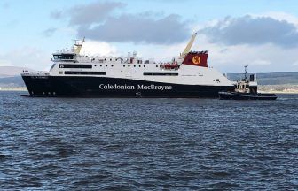
CalMac has said a number of ferry routes on the west coast are cancelled or are facing disruption.
Due to strong winds exceeding 50mph, the Forth Road Bridge was closed to double-deck buses, motorcycles, vehicles with trailers, cyclists and pedestrians.
Forecasters say a deep area of low pressure passing to the west of Scotland will drive exceptionally strong southwesterly winds into western and northern areas.
Gusts of 70–80mph are widely expected, with the possibility of 90mph gusts in exposed locations.
Insight Jo Farrow STV News weather forecaster
Scotland is stuck in a mild but wet and windy Atlantic flow this week. There have been bouts of heavy rain moving north-eastwards adding to rivers and puddles but also after the recent “Super” full moon there have been high spring tides and coastal flooding.
Next will be Storm Bram midweek, which has been named by Met Éireann, the Irish Meteorological Service which will bring more heavy rain on Tuesday morning.
This is the second named storm from the western naming group of UK, Ireland and the Met Office. Storm Amy was early in October and we have also seen Claudia which brought heavy rain to the UK. Claudia was named by the Spanish Met Service in a different southwest naming group.
Bram (as in Abraham) looks set to bring heavy rain from the south early on Tuesday. Much of mainland Scotland will see a grim Tuesday morning with heavy rain and blustery winds although it will feel strangely mild in this southerly flow. Don’t be fooled in northern Scotland early on Tuesday where there will be a calmer, drier start. The weather will deteriorate especially for the Western Isles.
Depending on the track of the windstorm it looks like the west coast of Ireland will see wild conditions by day and these should reach the west coast of Scotland by Tuesday afternoon.
The storm will then rage through Tuesday night for western Scotland with an Amber wind warning for the Western Isles. The wild weather will continue into Wednesday morning for the northwest and north of Scotland, particularly for the Islands. with a windy day across the mainland.
The winds will ease down as the storm slowly eases away northwards towards western Norway but it will take until Friday for calmer weather to arrive for Scotland.
A strong Jetstream across the Atlantic is directing low pressures our way and helping to deepen some of them. There has been cold air over North America which bought snow to Washington on Friday as the World Cup fixtures were being announced. There is still milder air over the mid-Atlantic and the stark temperature contrast helps strengthen the jet at this time of year.
Storm Bram will deepen rapidly on Tuesday as it moves northwards past western Ireland and then western Scotland. The Inshore Waters forecast from the Met Office mentions Severe gale force 9 winds, up to Storm force 10, even violent storm force 11 around The Minch with very rough, even high seas. Expect ferry disruption.
Follow STV News on WhatsApp
Scan the QR code on your mobile device for all the latest news from around the country