 NOAA
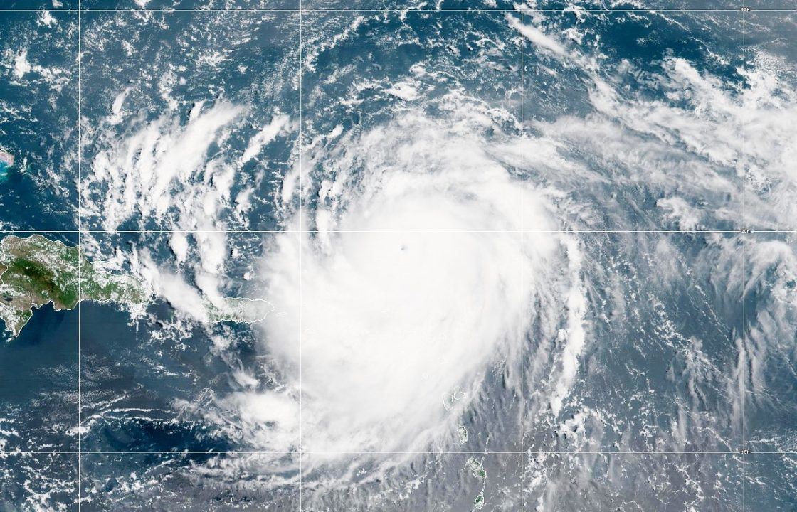
NOAAHurricane Erin is set to move across the Atlantic, bringing wind and rain to the UK.
The major category 3 hurricane is currently north-east of the Bahamas where it has come down from 140mph to 120mph and is expected to bring big waves to the east coast, the Met Office said.
It is forecast to remain out in the ocean, then the remnants of the hurricane could be seen in the UK by late Sunday.
There is a risk of rain developing and then the weather is expected to turn increasingly unsettled by the early to middle part of next week.
Wet and windy weather could be seen, with heavy downpours at times, and forecasters are monitoring it to decide whether to issue any rain warning nearer to the time.
It is set to end a period of dry weather for much of the country, with the UK on track for one of its hottest summers on record.
“At the moment, Hurricane Erin isn’t something we need to be particularly concerned about here in Scotland,” STV meteorologist Sean Batty said.
“The vast majority of current computer models don’t indicate any significant impact on the UK next week.
“That said, forecasting the remnants of hurricanes can be tricky, especially this far in advance.
“Right now, only about 5-10% of models show a deep low-pressure system west of the UK by Monday.
“A more likely outcome is that Erin’s remnants will simply bring an end to the drier, more settled weather we’ve been enjoying, leading to more changeable conditions later next week.
“As it stands, there’s nothing that raises concern. However, if that changes, I’ll be sure to keep you updated.”
In the lead-up to the weekend, inland and western areas will see sunny spells on Tuesday, potentially reaching 25C, while eastern coastal regions will remain cloudy, and light rain or drizzle will move south/south-west across northern and eastern Scotland.
Wednesday will bring dry weather to the UK and sunny spells will develop widely.
Daytime temperatures will be near normal for most areas, although it will feel cool near some North Sea coasts.
It comes after the summer has been marked by persistent warm temperatures even outside the heatwaves which have hit the country, with June and July both seeing well above-average conditions.
With two weeks to go until the end of the meteorological summer, conditions could still shift, but the season’s overall warmth and consistently above-average temperatures mean it could rank among the UK’s warmest in records dating back to 1884.
Provisional figures from the Met Office show that the UK’s average temperature from June 1 to August 17 stands at 16.2C, some 1.6C above the average temperature.
Follow STV News on WhatsApp
Scan the QR code on your mobile device for all the latest news from around the country