 iStock
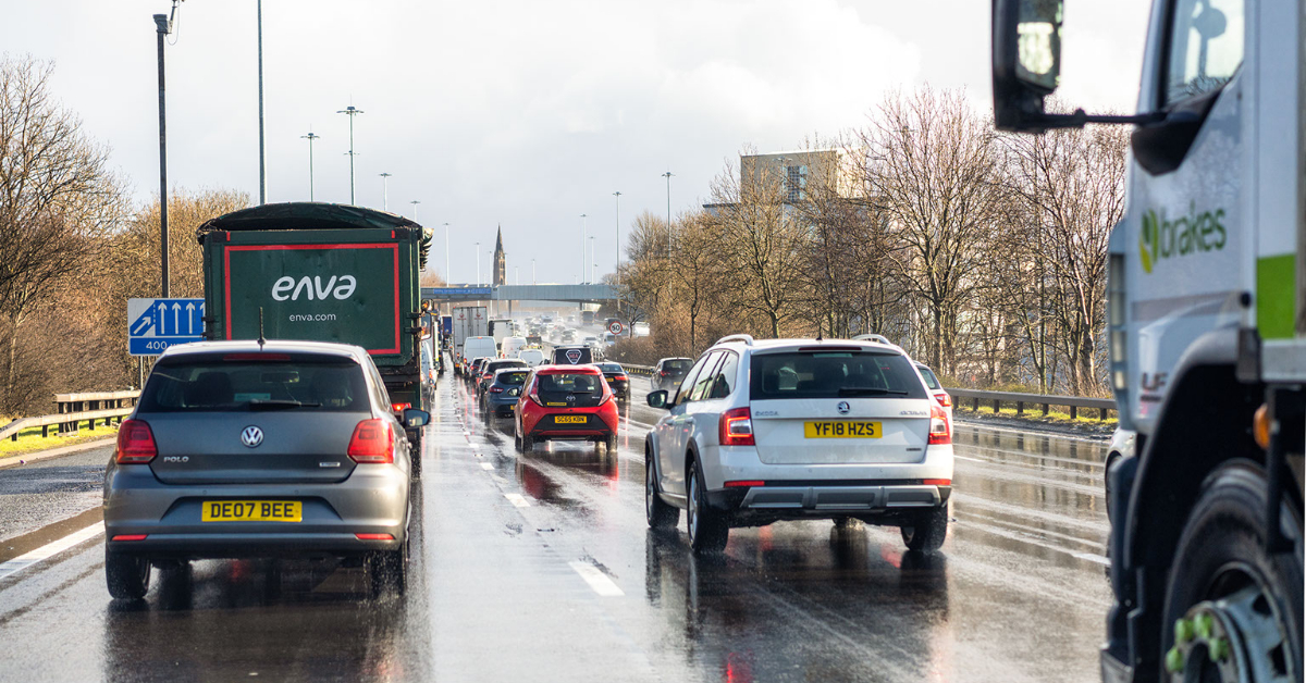
Glasgow is facing “extreme” traffic disruption as a large area of the city centre is locked down for the United Nations climate summit.
A road crash on the M8 at around 6.30am on Monday has caused disruption on the Kingston Bridge with a lane restricted on the eastbound offslip
The motorway was partially blocked westbound at J24 in Govan after another crash at around 7am.
The eastbound offslip at Bothwell Street is closed due to a road traffic collision shortly after 7am.
Queues were building up from the Clyde Tunnel with Traffic Scotland warning of delays.
A broken down vehicle at J28 Glasgow Airport on the eastbound onslip is blocking the road. Traffic is heavy in the area with around a 35-minute delay.
Road users have also been warned to use caution when crossing the Erskine Bridge due to high winds.
Lane 1 is closed on the M74 before 8am due to a crash westbound near Junction 24.
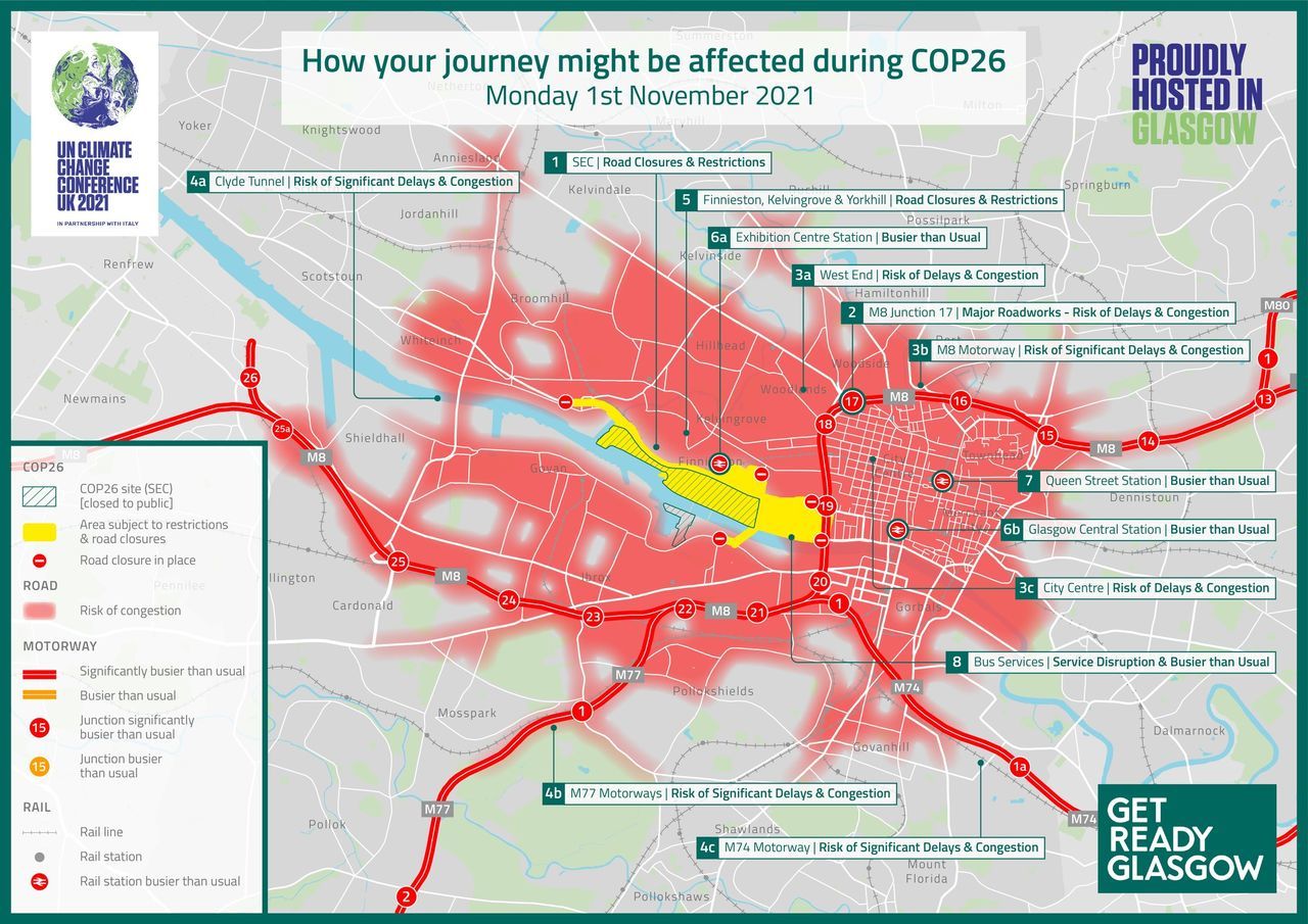
COP26 is being hosted on the banks of the Clyde at the Scottish Exhibition Centre and routes around the area are closed.
As well as pressure from road users, protests could cause further disruption throughout the twelve days of the conference.
 GCC
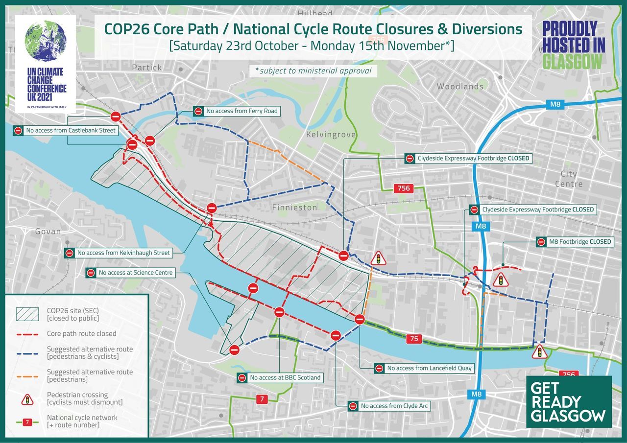
GCCPedestrian and cycle routes around the SEC will also be affected with campaigners saying the closures go against the ethos of the conference.
Buses will be busier than normal and they will also be at risk of disruption.
The city’s motorway network, already the busiest in the country, is expected to be “significantly busier than usual” with the M8, M77 and M74 all at risk of major congestion.
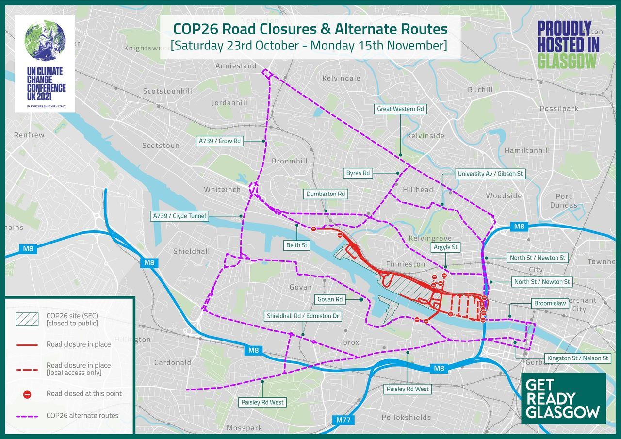
The Clydeside Expressway, which normally sees around 100,000 vehicles each day, is closed between Partick and Anderston for 23 days, between October 23 and November 15.
 Glasgow City Council
The council’s official alternate routes involve drivers using some of the busiest roads in the city with them being told to go through the Clyde Tunnel, travel parallel to the Expressway on Dumbarton Road and Argyle Street, or use Great Western Road, through Charing Cross.
The scale of the event in Glasgow is unprecedented in the UK.
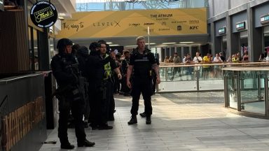
Around 10,000 police officers per day will be deployed, mostly from Police Scotland with support from other forces across the UK, as high-profile guests such as US President Joe Biden are expected.
An outer security fence around the SEC will provide a suitable “stand off” in “the event of a terrorist attack”, a council report said.
As part of its advice for those affected by the disruption, the council said roads that remain open “will be extremely busy”.
The Clydeside Expressway is the busiest road in Glasgow, with only the urban M8 motorway carrying more traffic through the city.
 GCC
GCCStobcross Road, which runs between the Expressway and the SEC, has already been closed due to works, and will not be open again until November 21.
Pressure from those unable to use their usual routes is expected to be diverted on to the A739, which runs north to south under the river as the Clyde Tunnel, as well as Paisley Road West, Great Western Road and Dumbarton Road.
The disruption from COP26 comes on top of traffic chaos already being caused by the ongoing repairs to the M8 Woodside Viaduct north of the city centre.
Congestion on the motorway through Glasgow will be even more severe during the climate summit and Charing Cross could be particularly bad.
A Glasgow City Council said: “COP26 will be unlike other major events Glasgow has hosted, bringing its own unique challenges for our travel network.
“Due to the scale and complexity of the event, which involves the likes of world leaders and climate activists, we will experience changes to the movement of traffic around the city.
“Businesses and residents directly affected by planned disruption will receive specific, direct communications forewarning them of the likely impact during specified periods and business engagement sessions will be publicised and held closer to the event.”
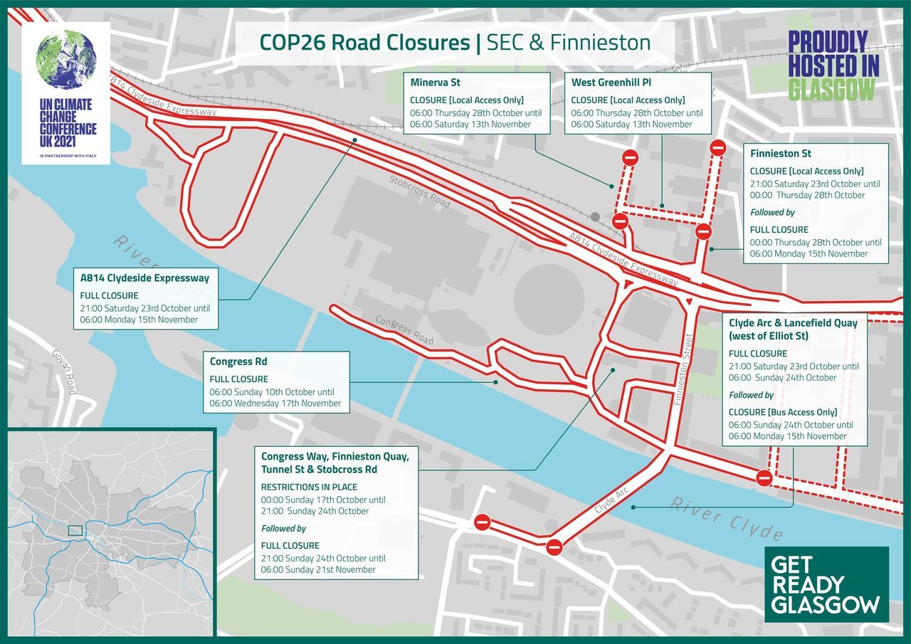
COP26 Road Closures
- Congress Road, closed from 6am, October 10, until 6am, November 17.
- Congress Way, Finnieston Quay, Tunnel Street, Stobcross Road (section parallel to A814) and Castlebank Street, subject to lane restrictions and closures between October 17 and 23, with full closure from 9pm on October 24 until 6am on November 21.
- Clyde Arc (Squinty Bridge) and Lancefield Quay, closed from 9pm on October 23 until 6am on November 15. The roads will be open to service buses only.
- Finnieston Street, from Houldsworth Street to Lancefield Quay, closed from 9pm on October 24 until 6am on November 15. Local Access southbound will be maintained until October 28.
- Clydeside Expressway, from Partick Interchange to Anderston (Junction 19), closed from 9pm on October 23, until 6am on November 15.
- Minerva Street and West Greenhill Place, closed from 6am on October 28, until 6am on November 13, with local access to private carparks maintained.
 GCC
GCC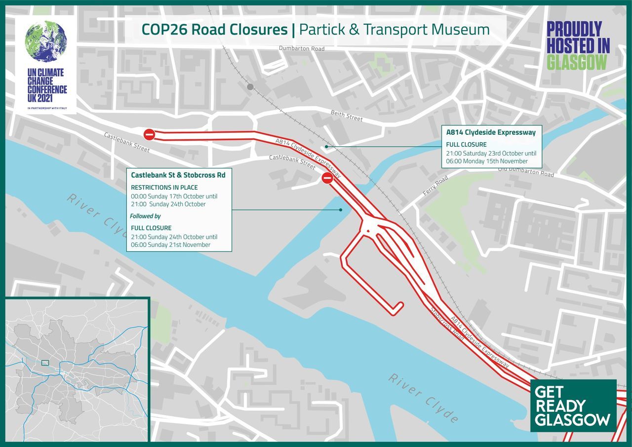 GCC
GCC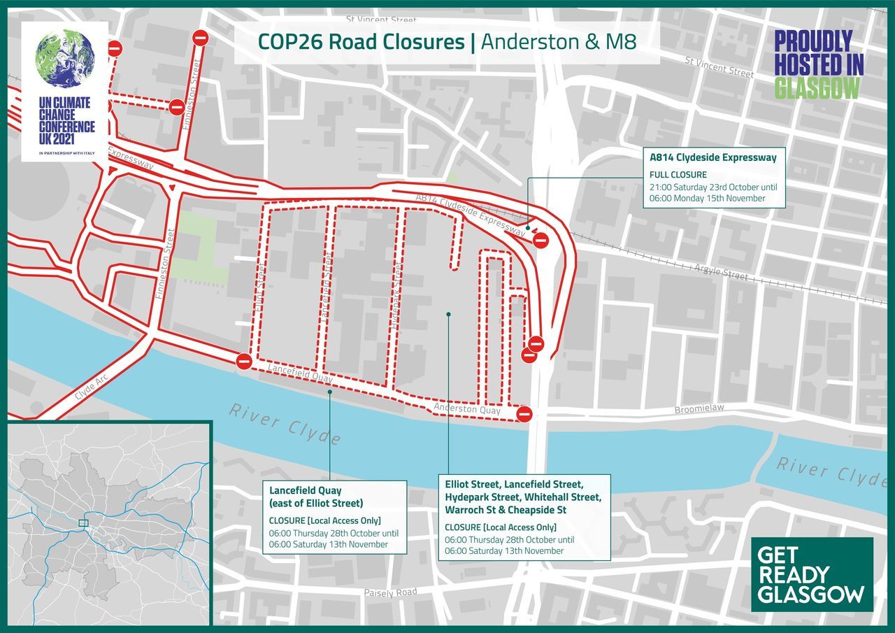 GCC
GCCFollow STV News on WhatsApp
Scan the QR code on your mobile device for all the latest news from around the country